
Goyder Highway (B64) is a west–east link through the Mid North region of South Australia connecting Spencer Gulf to the Riverland. It is part of the most direct road route from Port Augusta (and areas beyond including Eyre Peninsula, Western Australia and the Northern Territory) to much of Victoria and southern New South Wales.
Goyder Highway is named after George Goyder, a government surveyor who first identified and mapped Goyder's Line which indicates the northern limit of climatic suitability for intensive agriculture in South Australia. Goyder's Line is near the highway from Crystal Brook to past Burra.
Goyder Highway starts from the Augusta Highway at Crystal Brook running east then southeast. It is briefly concurrent with Horrocks Highway near Gulnare, RM Williams Way near Spalding and Barrier Highway near Burra. The highway descends from the Mount Lofty Ranges onto the plains of the Murray–Darling basin. It passes the end of Thiele Highway at Morgan and continues upstream on the north side of the Murray River to meet Sturt Highway between Barmera and Monash.
Start: Crystal Brook
Finish: Monash
Distance: 266 kilometres. The
distance shown at each locality along the way denotes its distance from Gawler
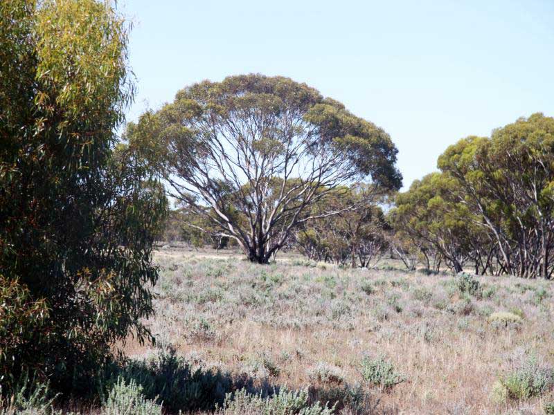
Crystal Brook is the second largest town after the city of Port Pirie in the Southern Flinders Ranges area. The shady peppercorn trees grace the main street, Bowman Street. The area where the present town is now was founded in 1839 by Edward John Eyre who was passing through the region. He named it after the beautiful sparkling clear water and named it 'Chrystal Brook'. Crystal Brook is situated on Goyder's Line near the border of two climate systems. While apparently cold semi-arid, the town benefits from a temperate mediterranean climate zone near to the east, making possible slightly more intense farming in the region. To the west and north-west lies some marginal, semi-arid farmland.
Gladstone 21 km north-east
Beetaloo Valley 15 km north
Port Pirie 29 km north-west
Port Broughton 41 km south west
Snowtown 52 km south

Gulnare, with a population of around 100, was also a station on the Gladstone-Balaklava railway line. The town takes its name from Gulnare Plain. It was also the name of the canine companion of explorer John Horrocks, who passed through the Gulnare area in 1841. Gulnare caught seven emus in five days, thus saving the party from hunger. Horrocks named the Gulnare Plains after him. The name, derived from an English spelling of Julnar the Sea-born in older English translations of the Arabian Nights, was the name of Colonel Light's ship, and appears in Lord Byron's Turkish Tales.
Spalding is a small town with a population of just over 200, and is located north of the Clare Valley. Spalding is located 117 km north of Adelaide and 43 km from the historic copper mining town of Burra. It is mainly a farming community and also is home to a slate quarry. Spalding was named by its founder, William Edward Lunn, after his birth place, the market town of Spalding, Lincolnshire in the UK.
The Riverton to Spalding Railway on the South Australian Railways network branched from the Adelaide-Peterborough line at Riverton and passed through the Clare Valley to Spalding. The line opened from Riverton to Clare on 5 July 1918, being extended to Spalding on 9 January 1922. The cessation of railway services was a consequence of the Ash Wednesday bushfires in February 1983, which caused major damage to infrastructure between Sevenhill and Penwortham. The line was formally closed on 17 April 1984. The section of the line between Riverton and Barinia has been converted into a Rail Trail, known as The Riesling Trail. The section from Riverton through Rhynie to Auburn was subsequently redeveloped as the Rattler Rail Trail and opened in 2010.
Canowie Belt 52 km north
Clare 39 km south
An historic former copper mining town nestled in the rolling hills north of Adelaide. The rich lode of copper discovered in the banks of the Burra Burra Creek in 1845 saved South Australia from bankruptsy. Today, thanks to the no-nonsense craftsmanship of its original masons and carpenters, Burra survives as a living museum of the industrial and domestic architecture of the mid-1800s. The ruins of the mine shafts, chimneys, engine houses and powder magazines still stand today as stark monuments to the arrival of the Industrial Revolution in a peaceful rural setting.
Eudunda 67 km south
Mt Bryan 15 km north
Terowie 62 km north
Peterborough 86 km north
Worlds End is 22 km south-east of Burra via the Goyder Highway. Worlds End Gorge (Burra Creek) is at Burra Creek Gorge Reserve, a popular campground where you can get water straight from the creek, though it has an earthy flavour. Facilities include drop toilets, picnic tables, rubbish bins and fire pits (BYO firewood). The Reserve is on the Heysen Trail. The remoteness, the lack of a mobile phone signal and the abandoned farm buildings and houses in the vicinity do give the impression that the world does end here.
Located on Goyder's Line, on the plains between Burra and Morgan, Bundey was named in 1878 for politician William Henry Bundey. The area was originally the territory of the Ngadjuri people. As a settlement, it didn't last long, suffering from its semi-arid location. Bundey Post Office opened on 1 May 1882 and closed on 1 October 1901. Bundey Immanuel Lutheran Church was established in 1889. The church building served as a school during the week, with lessons in a mixture of German and English, until its forced closure by the state government in 1917. The church itself closed in January 1925, and the building is now an abandoned ruin.
Morgan sits on the right bank of the Murray River, just downstream of where it turns from flowing roughly westwards to roughly southwards. Morgan is well known for its number of houseboats, and historic timber wharf. Many of the old buildings remain in the town. The town's famous wharf, built in 1878, was and still remains one of the most impressive examples of it's kind on the entire Murray River.
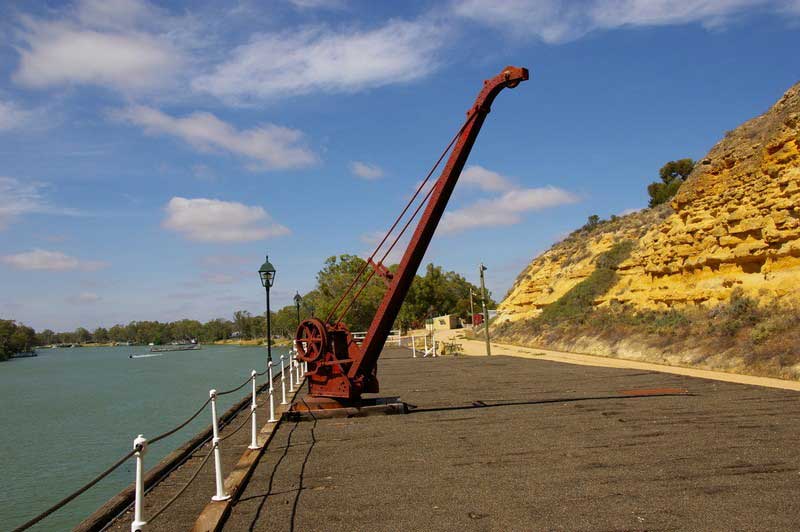
As Port Morgan became a huge success, during the height of the Paddle Steamer trade between 1880 and 1915, the massive 550 meter, red and blue gum wharf had 5 water hydraulic cranes, with gangs of up to 50 men working continuous 24 hour shifts. Today's remaining section of wharf was restored between 1996 and 1998.
Blanchetown 38 km south
Eudunda 58 km west
Taylorville, in the Riverland region of South Australia, sits on the north (right) bank of the Murray River opposite Waikerie and several smaller settlements. The locality is predominantly between the Goyder Highway and the Murray River, with several small areas on the other side of the highway. Taylorville Road connects the highway to the cable ferry across the river to Waikerie.
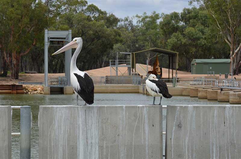
Barmera is one of the most popular aquatic playgrounds in South Australia. Situated in the heart of the Riverland, Barmera is a pretty town situated on the shores of Lake Bonney, a lake renowned for its sunsets. The Barmera region has some great wineries nearby. The Berri Estates Winery at Glossop, which is the largest distillery in the Southern Hemisphere, are both open for sales and tastings. Rural scenes around the Barmera district provide a constant variety of contrasts from irrigated fruit blocks to mallee scrublands. Dry farming with crops and grazing, marshlands, wetlands, riverside and lakeside are all within close proximity.
Renmark 32 km east
Loxton 35 km south
Berri 15 km east
The Riverland town of Monash is on the Sturt Highway between Barmera and Renmark. The renowned Monash Adventure Park is a free park that includes a maze, leaning towers and other fun activities, as well as free barbeques and shady trees. Opposite the park you will find a chocolate shop and a community club for bistro-style dining. Land at Monash was allocated to repatriated soldiers returned from World War I as part of the State Government Soldier Settler Scheme. The southern part of the settlement was occupied first and was originally known as Lone Gum after a prominent local landmark, a River Red Gum tree (Eucalyptus camaldulensis).
Renmark 20 km east


Design by W3layouts