Regional Drives in South Australia
The pick of the Regional Drives in South Australia ... in which getting there is truly half the fun.
 Eyre Highway (Nullarbor Plain)
Driving across the Nullarbor Plain is for many the quintessential experience of the Australian Outback. It is the ultimate Australian Road Trip and one every Australian should do at least once in their lifetime. It travels along one of the safest outback roads in Australia, with accommodation, cafes and vehicle repair facilities at regular intervals along the way.
 Flinders and Lincoln Highways Drive
The giant triangle of the Australian continent that juts out into the Great Australian Bight, Eyre Peninsula is one of the lesser known regions of Australia. The Flinders Highway, which follows its west coast from Ceduna to Port Lincoln and the tip of the Peninsula, is one of the least travelled highways, yet passes by some of the most unusual and interesting coastal vistas in the country.
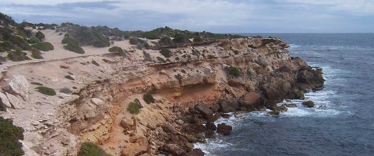
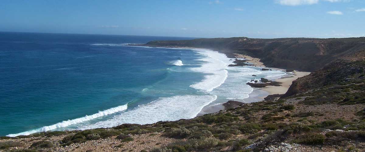 Westall Way
A short coastal drive, Westall Way is one of the Eyre Peninsula's best kept secrets, a showcase of an amazing variety of landforms and seascapes. Dotted along Westall Way are rugged limestone cliffs, granite boulders covered in golden lichen, secluded granite pools and the ever-present foaming white breakers of the Great Australian Bight. In stark contrast are the huge white Yanerbie sandhills. At Pt. Labbat, visitors are treated to a bird's eye view of Australia's only mainland sea-lion colony.
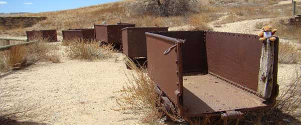
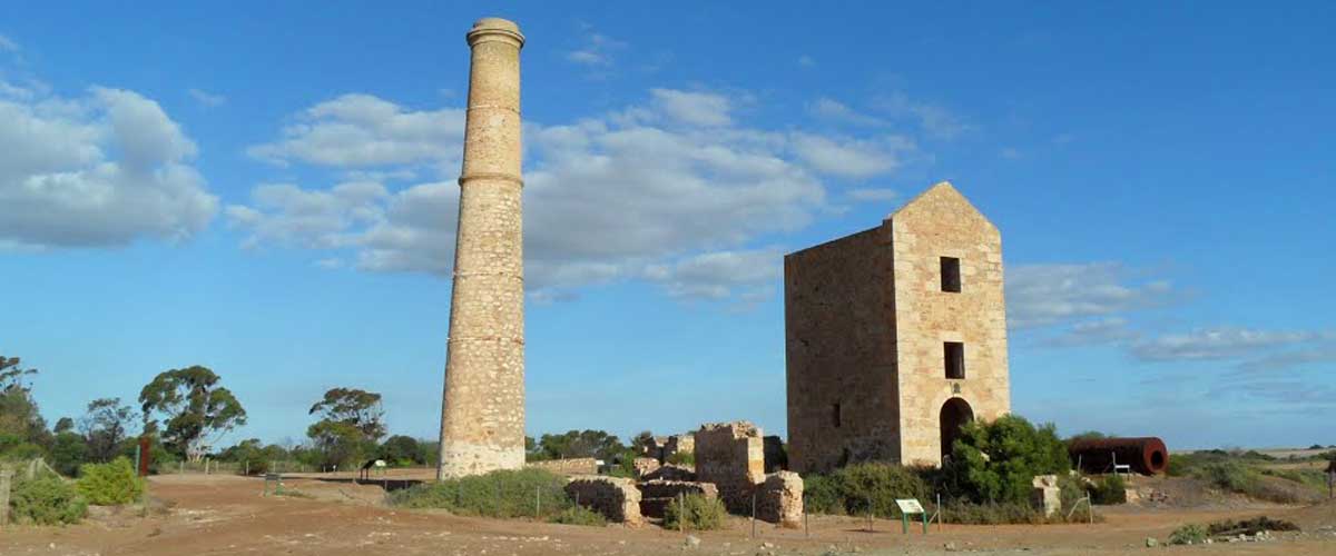 Copper Belt Circuit
When the Industrial Revolution was in full swing in 19th century England, machinery was at a premium and this meant a shortage of metals. Major English, Scottish and Welsh companies turned their sights on South Australia after a rich belt of copper was found. Its exploitation not only satisfied the demands in England, but brought much needed revenue to a colony close to bankruptcy. The legacy of those activities lives on in the former mining towns of Yorke Peninsula and the South Australian Wheatbelt.
 Follow The Original Ghan
The Ghan is one of the world's great rail journeys, a ribbon of steel through outback Australia that links Adelaide and Darwin. The original Ghan, named after the Afghan cameleers who helped open up the outback, first ran in 1879 between Port Augusta and Quorn. Over the next 50 years it was extended in stages through the Flinders Ranges to Maree and Oodnadatta, then finally to Alice Springs in 1929. When the second line was built and re-routed through Tarcoola in 1980, the Old Ghan line was left to the elements. To drive along the Oodnadatta Track and beyond in search of the remnants of the old line is a fascinating journey of discovery.
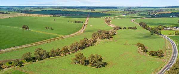
 Goyder Highway
Goyder Highway (B64) is a west–east link through the Mid North region of South Australia connecting Spencer Gulf to the Riverland. It is part of the most direct road route from Port Augusta (and areas beyond including Eyre Peninsula, Western Australia and the Northern Territory) to much of Victoria and southern New South Wales. Goyder Highway starts from the Augusta Highway at Crystal Brook. It is briefly concurrent with Horrocks Highway and Barrier Highway near Burra before descending from the Mount Lofty Ranges onto the plains of the Murray–Darling basin.
 Horrocks Highway
Main North Road is the major north-south arterial route through the suburbs north of the Adelaide City Centre in the city of Adelaide, South Australia. It continues north through the settled areas of South Australia and is a total of 307 kilometres long, from North Adelaide to Wilmington, 43 kilometres out of Port Augusta. It follows the route established in the early years of the colony by explorer John Horrocks and was a major route for farmers and graziers to reach the capital, passing through rich farmland and the Clare Valley wine region.
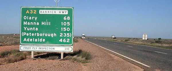 Barrier Highway
The Barrier Highway is part of the east-west link between Sydney and Perth. It also connects Broken Hill with Adelaide and is on the boundary of the Flinders Ranges and Outback of South Australia. The Highway passes through pastoral stations and the district boasts a rich mining and railway history. Evidence remains at the former gold-mining settlement Waukaringa, 45 kilometres north of Yunta - and the sidings along the railway line.
 Yorke Peninsula Circuit
Contained within approximately 563km of coastline, Yorke Peninsula stretches officially some 241kms, from Cape Spencer in the south through to Port Broughton in the north and separates the Spencer Gulf (to the west) from the St. Vincent Gulf to the east. At its widest (at Arthurton), the Peninsula is only 48km from coast to coast and this narrows to 32km down south. Around 12,000 people live on Yorke Peninsula in 12 main towns and 33 townships.
Design by W3layouts