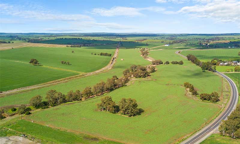
Main North Road is the major north-south arterial route through the suburbs north of the Adelaide City Centre in the city of Adelaide, South Australia. It continues north through the settled areas of South Australia and is a total of 307 kilometres long, from North Adelaide to Wilmington, 43 kilometres out of Port Augusta. It follows the route established in the early years of the colony by explorer John Horrocks and was a major route for farmers and graziers to reach the capital, passing through rich farmland and the Clare Valley wine region. In 2011, the section of road between Gawler to Wilmington was renamed Horrocks Highway.
The Great North Road leaves Adelaide through its northern suburbs, passing Mawson Lakes and Salisbury, crossing the Little Para River and passing Elizabeth and Smithfield before entering Gawler. In Gawler, it crosses the South Para and North Para Rivers, and the Barossa Valley Way branches to the east between them. Just north of Gawler, it passes under the Sturt Highway which heads east to the Barossa Valley, Riverland, northern Victoria and New South Wales. This is where the name Horrocks Highway takes over from the historic name of Main North Road, and where this drive commences.
Start: Gawler
Finish: Wilmington
Distance: 248 kilometres. The distance shown at each locality along the way denotes its distance from Gawler
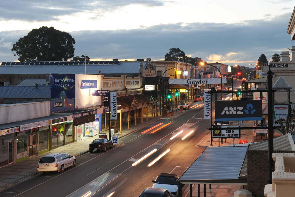
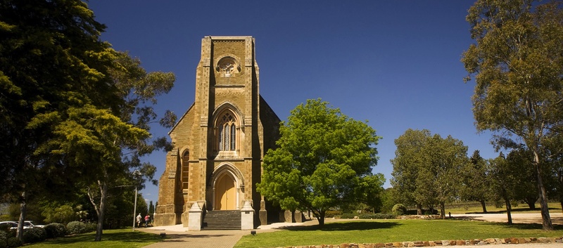
Gawler is the oldest country town in the state of South Australia. It was named after the second Governor (British Vice-Regal representative) of the colony of South Australia, George Gawler. It is about 40–44 km north of the centre of the state capital, Adelaide, and is close to the major wine producing district of the Barossa Valley. Topographically, Gawler lies at the confluence of two tributaries of the Gawler River, the North and South Para rivers, where they emerge from a range of low hills.
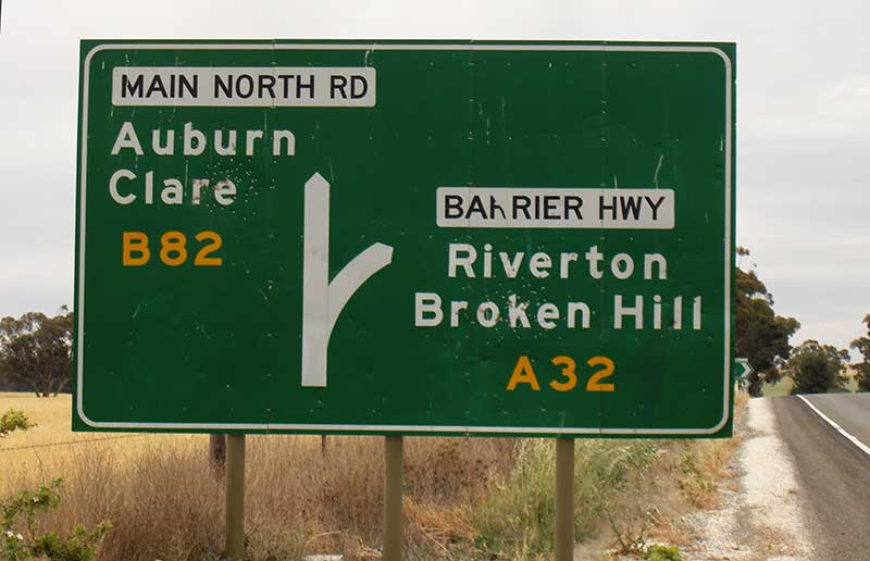
Giles Corner is the name of the intersection of Main North Road (now called Horrocks Highway) and commencement of the Barrier Highway, halfway between the towns of Tarlee and Rhynie, which branches off from Horrocks Highway at this location. Horrocks Highway continues in a northerly direction, on to the towns of Rhynie, Auburn and Clare. There is also an unsealed back road starting just north of the junction which heads west and ends at the road between Balaklava and Owen, approximately 20 kilometres away. Although not a town, Giles Corner is sign posted to mark its location.
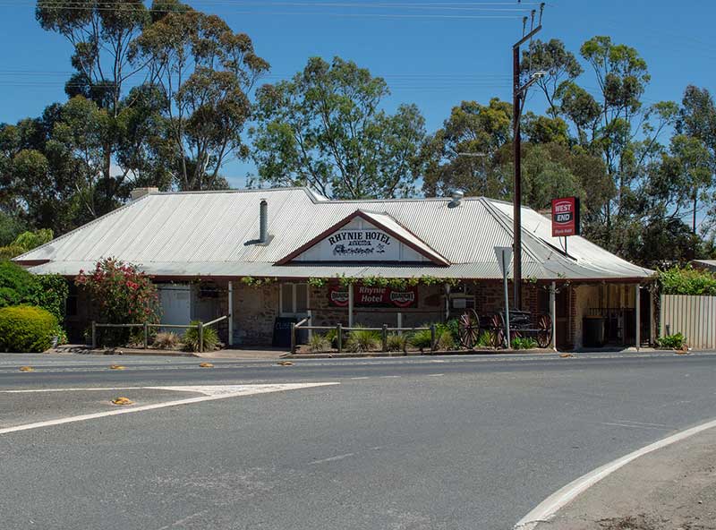
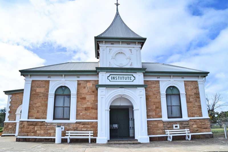
Rhynie is a small town, halfway between Tarlee and Auburn, along the Horrocks Highway. It is named after a village in Aberdeenshire, Scotland. Rhynie was surveyed and founded in 1859, prior to which the village was known as Baker’s Springs. Like Riverton, was on the Spalding railway line, which has now been closed and replaced by the Rattler Rail Trail cycling and walking path. The town has many heritage buildings, including the Rhynie Hotel, established in 1860, less than a year after the town was surveyed and founded.
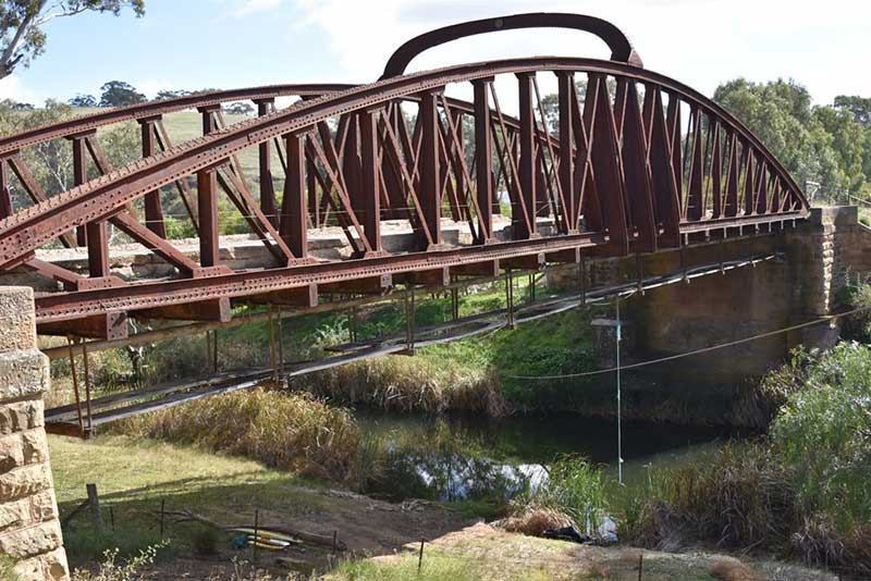
Undalya is a small rural town on the southern edge of the Clare Valley, approximately halfway between the towns of Auburn and Rhynie, at the junction of the River Wakefield and Pine Creek. To the east lies the town of Saddleworth and to the south-west lies the town of Balaklava. The most notable feature of Undalya is the local bridge over the River Wakefield. Built in 1855, with various alterations, additions and repairs, the bridge is known locally by three names: Basket Bridge, Cradle Bridge or Coathanger Bridge. It has taken the full force of many floods and at one time was the biggest one-span bridge in South Australia. The bridge is crossed by the Reisling Walking Trail.
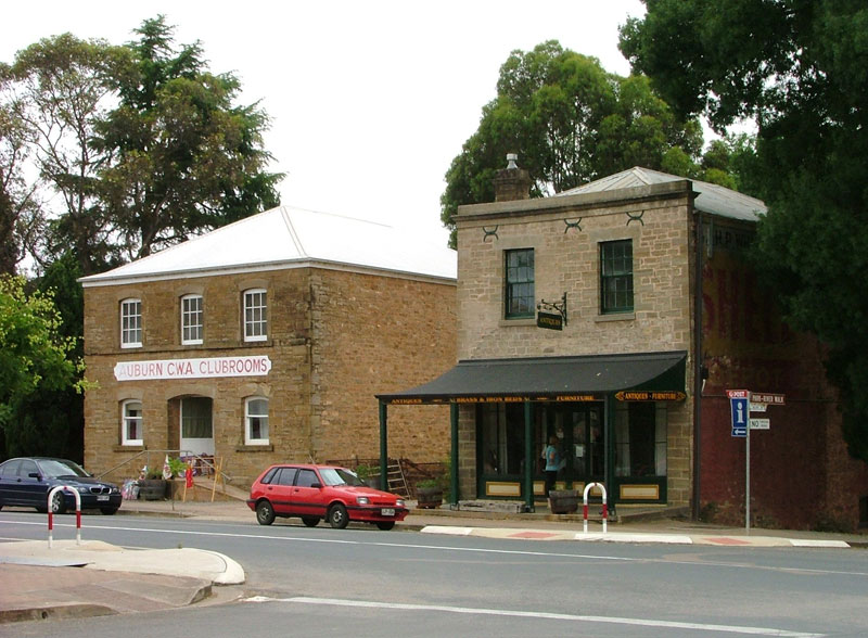
The historic town of Auburn is the southern gateway to the rich vineyards of the Clare Valley in South Australia's mid north. Every major building in the town has been classified by the National Trust, and there are numerous mellow heritage stone cottages available for accommodation for travellers and sojourners. As the gateway to the Clare Valley wine region, Auburn has wineries, restaurants, galleries, tearooms and a variety of shops. The village was the birthplace of one of Australia's great authors - C.J. Dennis, best known for the immensely popular 'The Songs of the Sentimental Bloke'.
Balaklava 30 km west
Manoora 15 km east
Eudunda 47 km south east
Although the surrounding country is elevated, the township is located in lower country at the intersection of Main North Road and the connecting roads to Mintaro (to the East) and Hoyleton (to the West) some 17 km south of Clare. Leasingham is bisected by the Eyre Creek as it makes its way to the Wakefield River. The Riesling Trail is on the western fringe of the township, following the former railway route between Auburn and Clare.
Leasingham is an agricultural district in which dry grain farming predominates. Additionally, being centrally located in quite a picturesque district, it caters for tourism and has a restaurant, caravan park, bed and breakfast accommodation and a number of tasting/cellar door sales operations of local wineries.
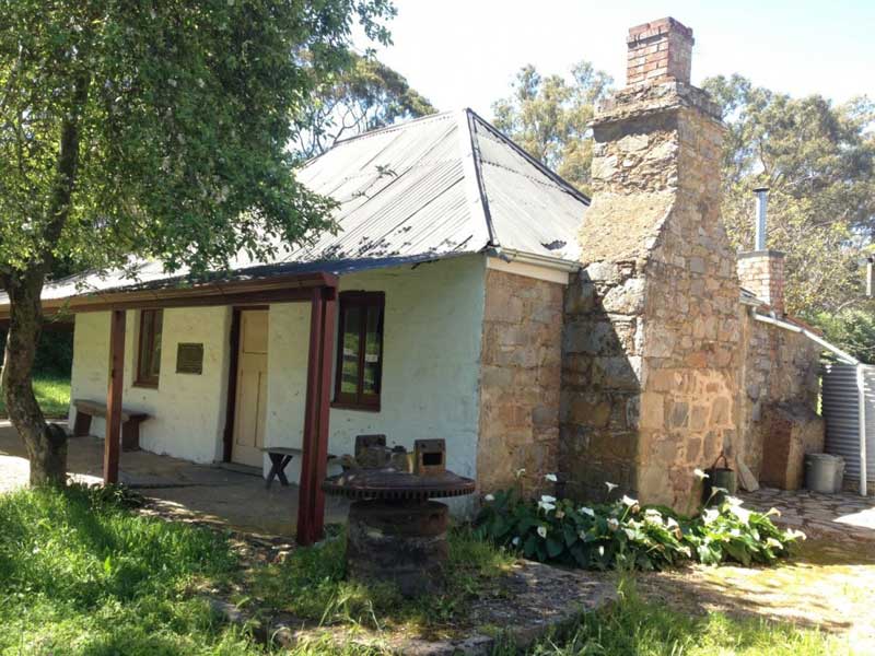
John Horrocks cottage, built c1839, Penwortham
The village of Penwortham, to the immediate south of Clare (10 km), is surrounded by natural eucalyptus bushland and a section of the Skilly Hills, which in turn forms part of the Mount Lofty Ranges. The village of Penwortham was founded by settler, pioneer and explorer, John Horrocks (1818-1846). Horrocks arrived in the colony of South Australia on his 21st birthday, 22 March 1839, less than three years after its proclamation by Governor John Hindmarsh.
Penwortham today is a sleepy, pretty village. Pearson Wines are located on the Main Road, a beautiful old stone building creating a delightful cellar door. St. Marks Church is a treasure, with explorer John Horrocks buried in the adjacent cemetery. Greens Cottage, built in 1839 and owned and operated by the local historical society, opens to visitors on the first Sunday of each month. The Riesling Trail, on the eastern side links the village to Auburn and Clare for walkers and cyclists looking to take in the ambience of the local countryside. The scenic drive to the Skillogalee Valley, west of the Main North Road, can be accessed from Penwortham. This beautiful scenic drive will take you to several well-known cellar doors, Mitchell Wines, Penna Lane Wines, Kilikanoon Wines and Skillogalee Wines and Restaurant.
Sevenhill was established by Austrian Jesuits who fled their country to escape political and religious oppression. The immigrants settled near the township of Clare and the Jesuits, impressed by the fertility of the local soil, purchased 100 acres of land in 1851, naming it Sevenhill after the Seven Hill district of Rome. Sevenhill is now at the 'heart' of the Clare Valley, and is a hub for the locals and tourists visiting the Region. It is a perfect place to gain access to the Riesling trail walking and cycling route, just east of the town, with off-road parking facilities available.
Mintaro 30 km west
Manoora 15 km east
Eudunda 11.5 km east
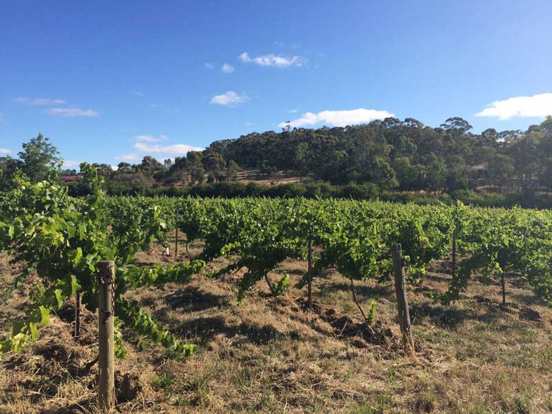
Clare is a major town and service centre in the heart of the Clare Valley, one of South Australia's premier wine growing districts. The Clare Valley Region today hosts a vibrant, diversified rural community and economy. The delightful rolling hills create beautiful landscapes, dotted with wonderful stone buildings. The Region attracts many discerning tourists, both domestic and international, who delight and relax in the friendly environment. Major attractions include the unique, boutique wineries and cellar doors, treed landscapes that can be easily accessed on The Riesling Trail (walk or cycle), the fine stone buildings and homes, and the excellent local cuisine. Regular markets create opportunities to mix with the locals and immerse yourself in unique activities.
Farrell Flat 20 km east
Burra 42 km north-east
Blyth 13 km west
Moonta 102 km west
Snowtown 43 km west
Port Wakefield 76 km south-west

The Brinkworth area was first settled in the 1860s and the town laid out in 1892 as a railway town. Brinkworth is named after the early landowner, George Brinkworth. Brinkworth was a major railway junction described as “the Great Junction of the Blyth, Snowtown and Gladstone Railways”. The railway’s history can be easily appreciated by reading the informative signs along the Peppertree Trail, a 2.4km return walk along the old track, from the original stockyards to the junction where the lines diverged to Blyth or Snowtown. The town's hotel is appropriately called the Junction Hotel.
Snowtown 22 km west
Lochiel 40 km south west
Nestled in a shallow valley on the Broughton River, Yacka is about half an hour from the Clare Valley wine region, en route to the Flinders Ranges. Yacka was a station on the Gladstone-Balaklava railway, built as narrow gauge in 1894, converted to broad gauge in 1927 and closed by 1993. Fewer than 100 people live in the town and its farming hinterland today, but community spirit is strong. Yackamoorundie Park, on the banks of the Broughton, provides a welcoming and much-appreciated environment for passers-by, picnickers and campers. It has free electric barbecue facilities, woodfire barbecue facilities (not available for use in fire danger season), playground equipment, clean toilets and picnic tables.

Gulnare, with a population of around 100, was also a station on the Gladstone-Balaklava railway line. The town takes its name from Gulnare Plain. It was also the name of the canine companion of explorer John Horrocks, who passed through the Gulnare area in 1841. Gulnare caught seven emus in five days, thus saving the party from hunger. Horrocks named the Gulnare Plains after him. The name, derived from an English spelling of Julnar the Sea-born in older English translations of the Arabian Nights, was the name of Colonel Light's ship, and appears in Lord Byron's Turkish Tales.
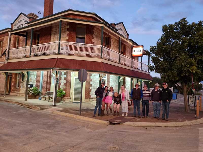
A Wheatbelt service town, Georgetown was one of the first towns to be surveyed in the upper Mid North when the Strangways Act was passed in 1869 to authorise resumption of pastoral leases to enable closer settlement for more intensive farming purposes. It was surveyed in 1869, along with Redhill. The township's survey, made in 1869, was on a grand scale. The town was planned as a miniature Adelaide, with north, south, east and west terraces. At first Georgetown flourished with settlement and businesses; but its prosperity declined when, as a result of political pressures, the railway line at first proposed to pass through Georgetown and Narridy was diverted to run through Jamestown and Caltowie to Port Pirie. On either side of the street are a number of prominent buildings including the National Australia Bank (1885), the Belalie Hotel (1877) and the Commercial Hotel (1877).

A Wheatbelt service town, Gladstone was once a major railway head. Train spotters once came to Gladstone to see one of the wonders of the railway world. It is here that three railway gauges - narrow (3'6"), standard (4'8.5") and broad (5'3") - all meet. At the railway yards it was possible to see the three gauges beside each other as well as one of the world's few junction points of 3 gauges integrated together in a single siding. Gladstone boasts the largest grain silos in South Australia. Gladstone prides itself on being the southern gateway to the Flinders Ranges.
The town's main attraction is Gladstone Gaol, located in Park Terrace at the northern end of town, which was built between 1879-81. There were only 20 escapes in the gaol's 100 year history. It was eventually closed down in 1975 and opened to visitors in 1978.
Crystal Brook 21 km souh-west
Port Pirie 38 km west
Jamestown 28 km east
Terowie 65 km east
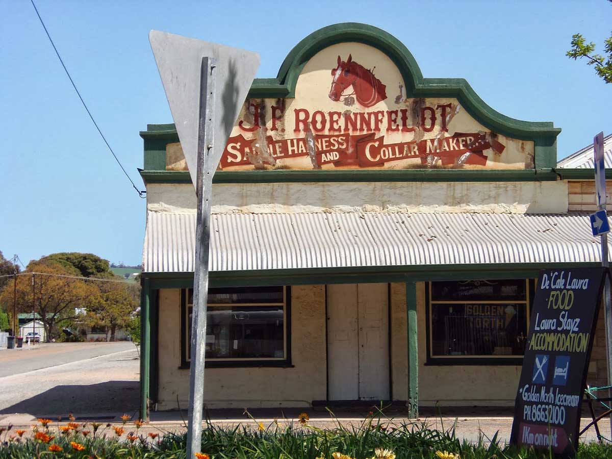
Laura is a small and attractive township located on the eastern slopes of the lower Flinders Ranges in the shadow of Mt Remarkable, 218 km from Adelaide. It is a town characterised by one of the widest main streets in South Australia with stands of peppercorns and gumtrees enhancing the street. Today the shopping centre is quite unusual in the sense that there are little blocks of two or three shops separated by a few houses, then a few more shops - all this is in the long main street. In recent times its future has been tied to a proliferation of gift and craft shops which have breathed new life into the town.
Peterborough 81 km north east
Port Pirie 42 km west
Jamestown 28 km east
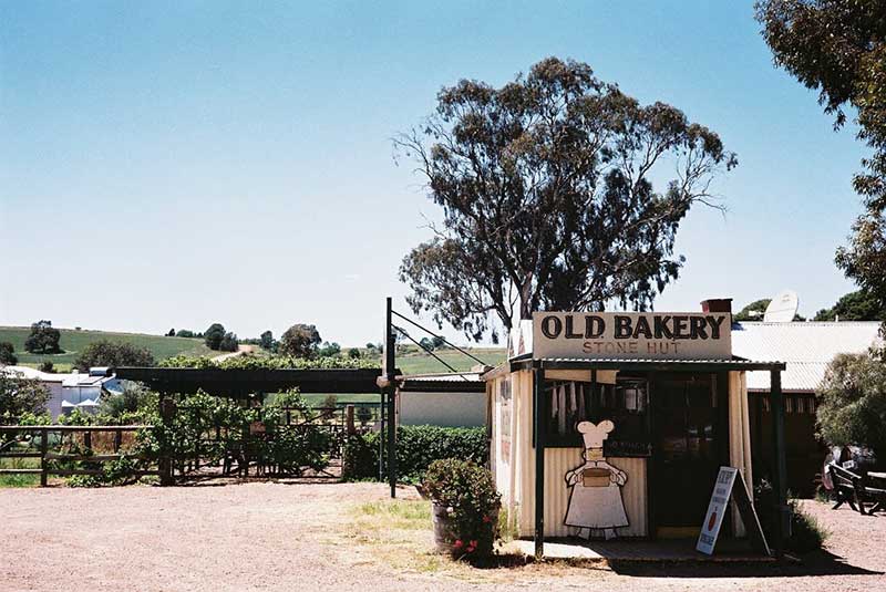
Stone Hut was established in 1871, as the agriculturalists spread north, but the original (and still existing) hut, a staging post between Adelaide and the north, was built much earlier. Surrounded by spectacular scenery, Stone Hut with its Bakery and Cottage Accommodation is a well-known landmark on the road between Laura and Wirrabara. While every pie lover will have their own criteria for what makes a great pie, it is hard to go past the size, homestyle look and flavour of Stone Hut Bakery pies. Next to the outdoor eating area is a large walk-in bird aviary with cockatoos, galahs and parrots.
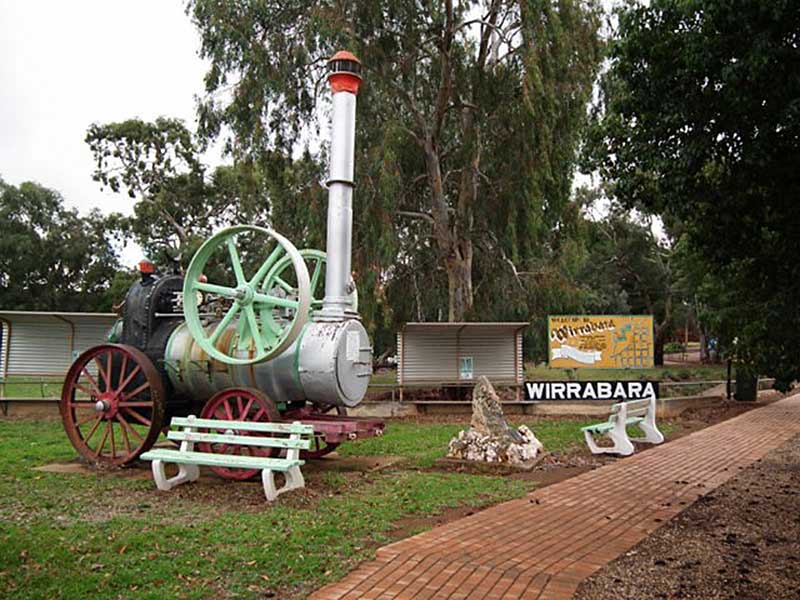
Wirrabara was proclaimed in 1874, its name is a a native word meaning 'forest with running water'. The magnificent steam engine on display in the town's main steeet was used by woodcutters to power a saw which cut timber to make the sleepers for the railway lines through the Mid North. Wirrabara supplied half a million sleepers between 1880 and 1887. The township was developed on a portion of Wirrabara (formely Charlton) station. Fortunately the highway continues to pass through the township, assisting its now stuggling economy.
Now a quiet backwater to the south of Melrose, Murray Town was once a bustling community. European settlers first arrived in 1883 and very soon teams transporting livestock began passing through. Its name from pioneer Alexander Murray, who introduced the Murray Merino sheep breed. The history of Murray Town is revealed on plaques at the park and with an old plough, made at the Murray Town Blacksmith Shop in 1900, on display. Painted Stobie (power) poles tell the town's story. Picnic and campgrounds are conveniently located in the main street.
Port Germeine 31 km west
Booleroo Centre: 14 km north east
A small township at the foot of Mt. Remarkable, Melrose proudly declares itself the 'oldest town in the Flinders Ranges'. Melrose is a quiet and attractive town nestled below the Flinders Ranges. There are many interesting historic buildings in town and the area around the town is ideal for bushwalking. Mt. Remarkable is a popular destination for bushwalking and camping, the dramatic gorges, walking trails and diverse wildlife are just the beginning of its appeal. The park features the 960m high Mount Remarkable Summit which can be reached along the Mount Remarkable Summit Hike from Melrose, providing impressive views of Willochra Plain and Spencer Gulf.
Originally known as Beautiful Valley, Wilmington is a small town nestled in a lovely part of the lower Flinders Ranges, surrounded by highly productive rural holdings. The settlement grew around an inn (built 1861) which became a Cobb & Co. staging post. Very little has changed in the town from those early days.
Orroroo 52 km east
Quorn 40 km north
Port Augusta 43 km north-west
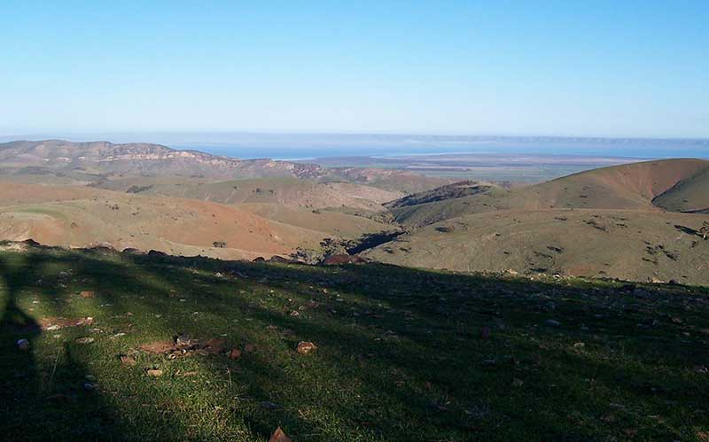
Hancocks Lookout
Continue through Wilmington on Horrocks Pass Road towards Port Augusta, and you will come to a turn off to Hancock's Lookout. Located 11 km from Wilmington, the lookout affords panoramic views of the coastal plain and the gulf. Continue on Horrocks Pass Road, traverse the pass and you will come to Augusta Highway at Winninowie. Augusta Highway is part of the Australian National Highway on Highway 1. Port August is a further 21 kilometres away on the plain between Spencer Gulf to the west and the southern Flinders Ranges to the east. A railway siding at Winninowie opened with the line in 1936; a crossing loop remains there today.


Design by W3layouts