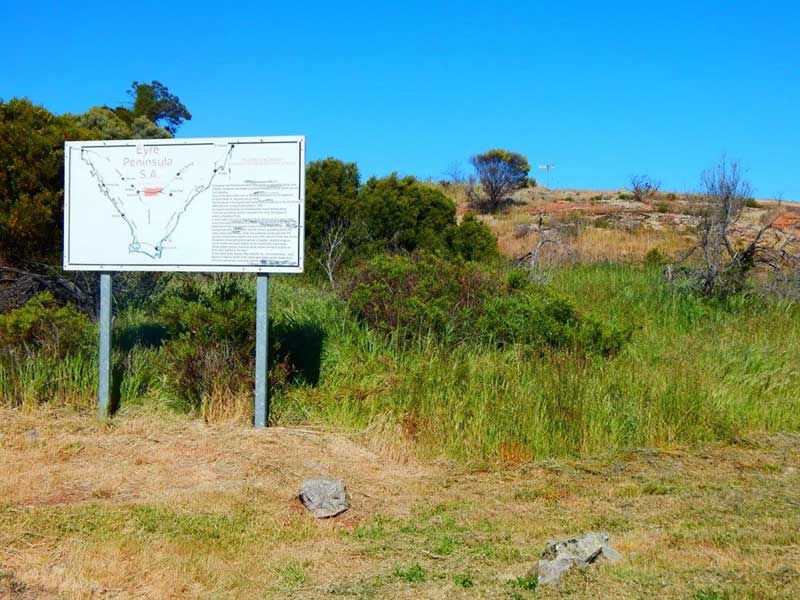
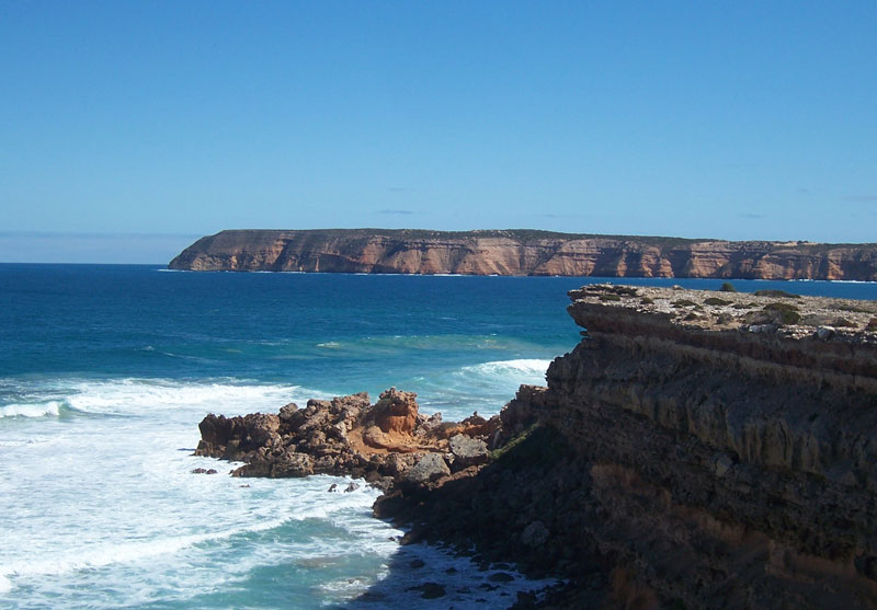
A giant triangle of the Australian continent that juts out into the Gt Australian Bight, Eyre Peninsula is one of the lesser known regions of Australia. The Flinders Highway, which follows its west coast, is one of Australia's least travelled highways, yet passes by some of the most unusual and visually diverse coastal vistas in the country.
Perhaps because of its position, very few travellers venture along the west coast of South Australia's Eyre Peninsula. Most that do are either South Australians who are aware of the secrets held by this corner of the country, or are drivers making the Nullarbor crossing with time on their hands who opt to take the long way round on their passage between Port Augusta and Ceduna. Whether you are a Nullarbor traveller who takes the long route, or you drive the triangle of highway that links Port Augusta, Ceduna and Port Lincoln, you'll be pleasantly surprised at what you'll find here.
Location: Eyre Peninsula, South Australia
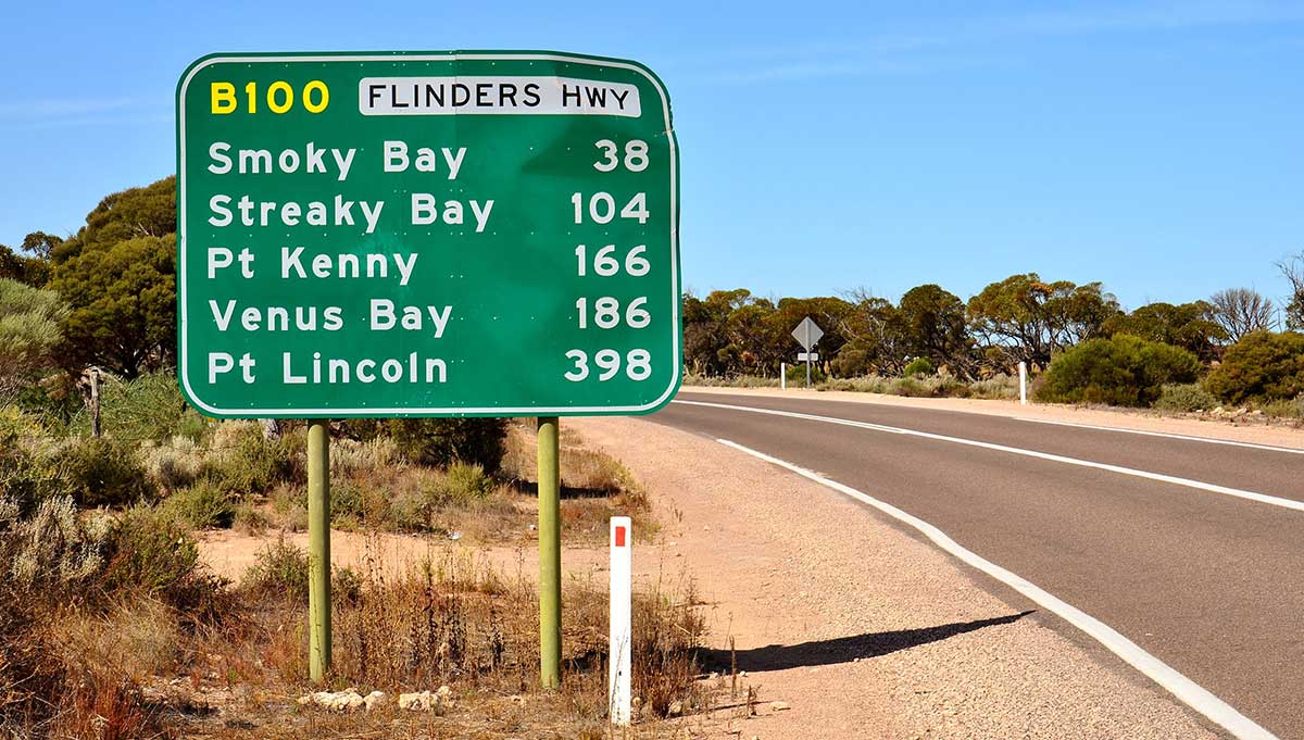
Ceduna - Port Lincoln (Flinders Hwy): 406 km
Port Lincoln - Port Augusta (Lincoln Hwy): 354 km
Port Augusta - Ceduna (Eyre Highway): 467 km
Suggested return journey: the drive is a loop, commencing and finishing at Port Augusta
Features/attractions: coastal cliffs; Pt. Labatt sea-lion colony; Whaler's Way; Coffin Bay National Park; Lincoln National Park
Minimum duration (one way): two days. Recommended: 1 week
Commencing at Port Augusta, travel east along the Eyre Highway. This stretch of road passes the Gawler Ranges, the peninsula's Granite Country and a section of the state's wheatbelt. A sign at Kimba marks the halfway point between Sydney and Perth via Eyre Highway.
Gawler Ranges National Park, in the northern region of Eyre Peninsula, contains some of the oldest rock formations on the planet. One of the largest was named by the explorer Edward John Eyre during an attempt to cross from South Australia to the West. He called it Mount Sturt, his way of honouring another great adventurer Captain Charles Sturt. From its southern base you take in the great sweep of salt lakes that drain into the Corribbinnie Depression. The Gawler Ranges, which cover an area of seventeen thousand square kilometres, are all volcanic and appear to have come into existence at the one time.
The remains of a massive formations found here are just a small part of what's known to geologists and the mining companies as the Gawler Craton. With endless tracks providing endless vistas of an ancient volcanic madness it's little wonder that more and more four-wheel drive enthusiasts are making their way into the Gawler Ranges National Park.
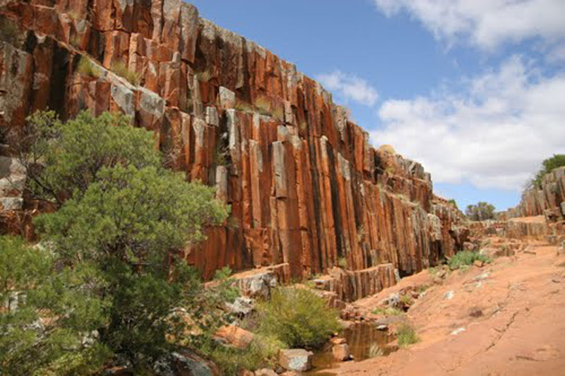
The National Park was declared in 2001. For about one hundred years it was a sheep grazing property. The friends of the park have now restored old Panney Homestead. This century old piece of South Australian farming history is available to rent for those who want a holiday with a difference. The neighbors certainly aren't a bother - after all they're 50 kilometres away. From low-lying scrub to more heavily wooded country the park is an ever-changing array of scenery. But the ranges serve as a constant reminder of this part of Upper Eyre Peninsula's volcanic past. An example is the formation known as the Organ Pipes - one of the Park's most popular features.
In one great volcanic upheaval, the earth's core spewed forth creating molten madness, which, over time, has set in cathedral-like spires in the South Australian bush. The rock is known as Ryolite. It's some of the oldest on the Australian continent. And the reason it's been formed in these amazing shapes is all to do with the rate of cooling so many millions of years ago. These rocks are supposed to be around one point five billion years old. If you like they are the bare bones of the Australian continent - maybe the world.
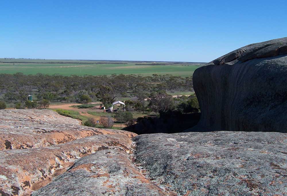
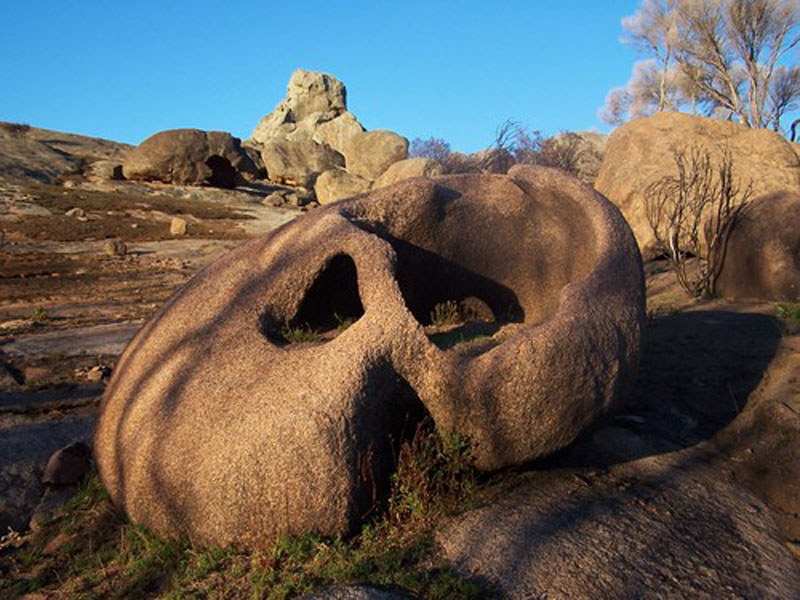
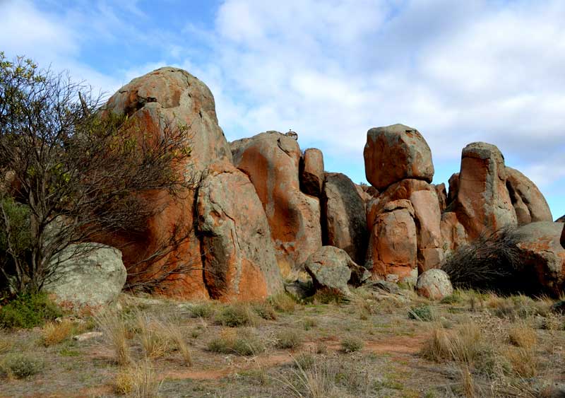
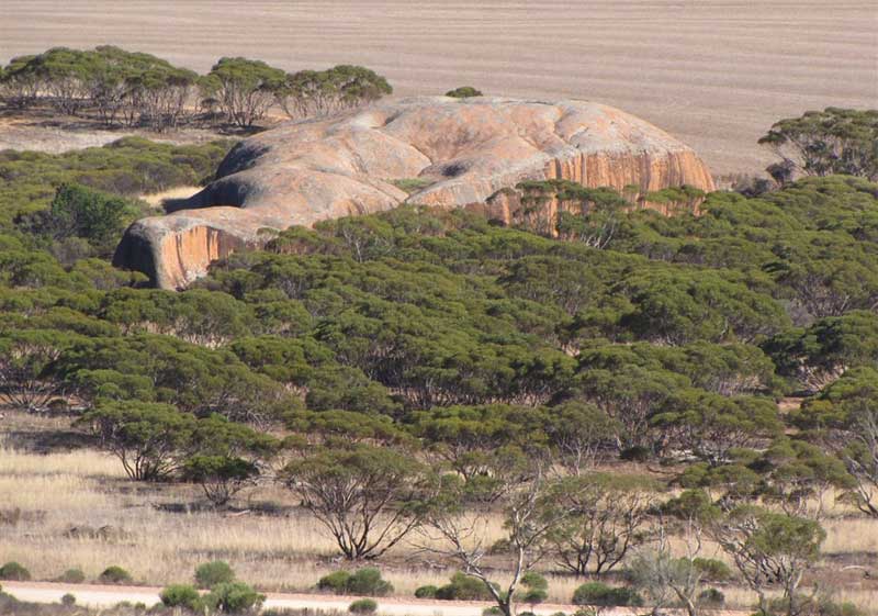
Wudinna is at the centre of South Australia's Granite region. It was formed about 1500 million years ago, the granite outcrops in the northern section of the Eyre Peninsula are part of the vast Gawler Craton. The region has many granite outcrops that are interesting to visit and often quite photogenic.
Formed about 1500 million years ago, the granite outcrops in the northern section of the Eyre Peninsula are part of the vast Gawler Craton - a geological shield structure covering central Eyre Peninsula, the Gawler Ranges and large parts of outback South Australia. Geologists refer to the inselbergs in the area as belonging to the Hiltaba suite of rocks - basically orthoclase rich pink granites dating from Eyre Peninsula's Precambrian age.
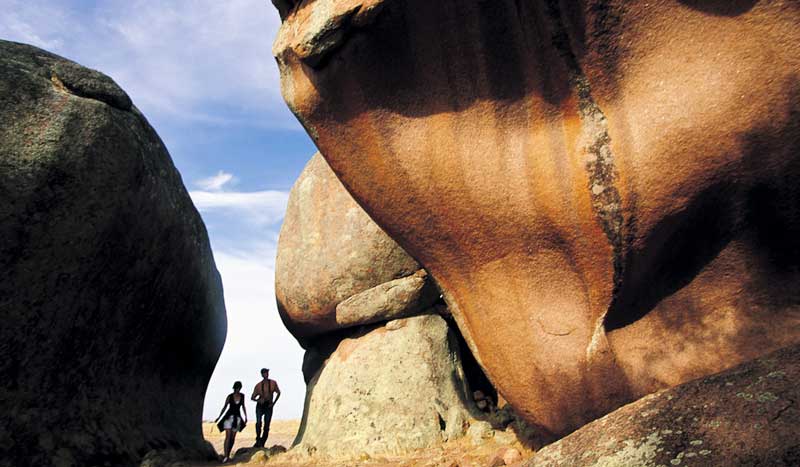
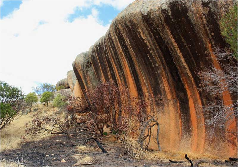
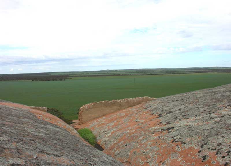
Nearby the Gawler Ranges were formed as a result of volcanic action. Unlike the Gawler Ranges however, Eyre Peninsula's inselbergs were formed as Batholiths or granite domes some 7 kilometres below the earth's surface. Clearly much soil erosion has occurred during the past 1500 million years. Equally remarkably, Pildappa Rock and many other Australian inselbergs exhibit very slow rates of weathering - with numerous studies indicating exposed granite surfaces eroding at rates below 50 centimetres per million years.
Geologists believe the process of the unique wave form or "flare" structure common to a number of granite outcrops in the area formation typically involves water runoff seeping into the soil at the base of granite rock faces. Over time, water and permanently moist soil conditions act together to chemically weather away highly reactive granite minerals such as orthoclase and mica. All this can take place at depths of up to 30 metres below the surface. In the case of Pildappa Rock, for example, soil levels have also gradually eroded away thereby exposing the prominent flare structure that we can see today.
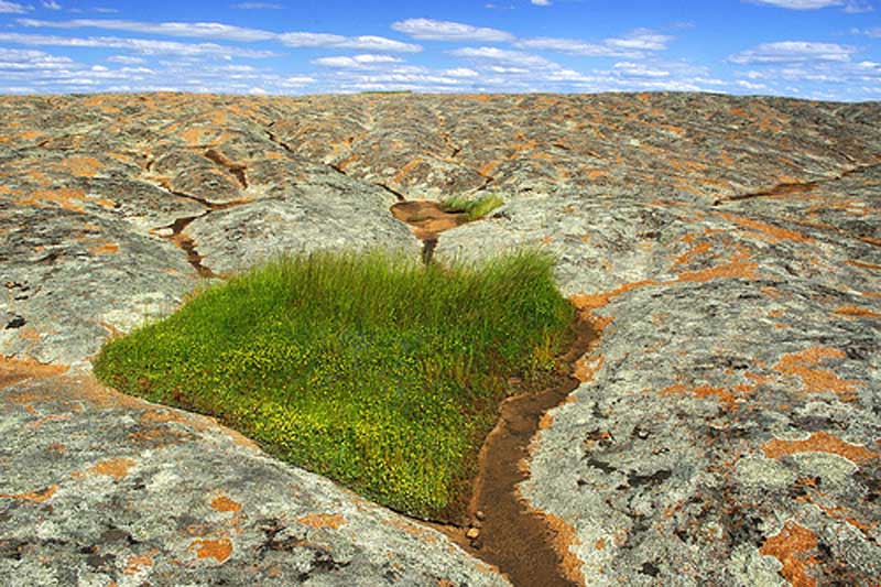
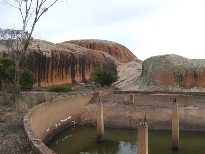
Typical inselberg landforms can also be seen. Decaying granite sheet structures, minor tafoni forms, and "water grooves" known as rillen can all be found. Gnamma waterholes are often to be found at the top of the larger granite outcrops.
Prior to European settlement gnamma rockholes were the only permanent source of water to be found in this part of Eyre Peninsula. For the local Kukatha tribe of aborigines such rockholes were an essential survival resource in a characteristically dry and arid environment. Early European settlers also recognised the value of such waterholes. At Pildappa pioneering farmers even constructed dam walls at the top of the rock in order to increase the rainfall catchment area of gnamma rockholes.
A unique pink inselberg located 15 kilometres northeast of Minnipa on the Eyre Peninsula. Situated in South Australia's granite country, locals proudly proclaim Pildappa to rival the more famous "Wave Rock" - a sandstone wave form located in Hyden, Western Australia. Below Pildappa Rock visitors will find an extensive system of man made gutters. These gutters were constructed in 1928 and designed to channel water runoff into a huge underground water tank on the northern side of Pildappa Rock.
A small conservation park preserves the ancient granite dome known as Corrobinnie Hill. Over the millennia, the granite has weathered into an amazing array of boulders and caves. From the top of Corrobinnie Hill there are sweeping 360 degree views of the surrounding farming country and granite outcrops. Access is stictly limited to 4WD, from Wudinna in the south or the Buckleboo Stock Route in the north.
The most southerly outcrop in the Gawler Ranges granite belt, Murphy's Haystracks is located approximately 40km south of Streaky Bay. The term "Haystacks" is something of a misnomer. These haystacks have nothing to do with farming and are in fact very fine examples of weathered granite inselberg structures including boulders and pillars. Upon entering the viewing area a unique and magnificent Tafoni structure can be seen towering above the walkway.
Elsewhere within the viewing area a variety of wave forms and flared rock structures can be seen. These are indicative of ancient physical and chemical weathering processes occuring when soil levels were several metres higher than now. These inselbergs are exemplified by finely sculpted pink granite forms that are often encrusted with lichen growths. Located near to the entrance of Murphys Haystacks is a picnic area with toilet facilities.
Located 32 km south of Wudinna township, Ucontitchie Hill is a domed granite formation rising to a height of 37 metres above the surrounding plain. As an Inselberg structure it is of international geological significance and exhibits many well developed and well defined structures and forms that are a result of chemical weathering processes. Around the base of the hill can be seen unique wave structures indicating previous levels of long since eroded soils. As you rise to the peak of Ucontitchie Hill you can observe vast slab like structures and fascinating sheets and boulders of granite that have been internally eroded into features known as Tafoni.
Located within an attractive reserve, Polda Rock was originally used as the catchment for the town of Wudinna's water supply. Much of the original infrastructure erected to catch water flowing off the rock during rain, including a hand constructed stone channel, and a reservoir remain in use. A popular reserve for short walks, bird watching and picnics.
Located adjacent to Eyre Highway at Koongawa, east of Wudinna, Waddikee Rock is a small exposed granite dome that provides excellent views of the surrounding landscape. A monument to John Charles Drake, who was speared by natives whilst travelling through the area, is located at the base of the rock.
Located within the Mt Wudinna Recreation Reserve, Mount Wudinna is Australia's second largest monolith after Mount Augustus. It is located 12 kilometres north-east of the township of Wudinna. Mt Wudinna rises 80 metres above the surrounding farmland. On the way to Mt Wundinna, just past Polda Rock, Little Mt Wudinna and Cottage Loaf Rock can be seen on the left and a working granite quarry on the right. Mount Wudinna, like many of the bare granite hills in the district, is encompassed by low stone walls to catch and divert run off water. The site is listed on the South Australian Heritage Register.
Located 6 km east of Minnipa, the Tcharkuldu Rock granite outcrop boasts numerous large granite boulders and tafoni which makes it a unique outcrop from others in the district. Tafoni are internally eroded rocks, which have resulted in cave like formations. A family of Euros is also said to live permanently at the site.
Located 4 km north of the township of Minnipa on the way to the Gawler Ranges. Yarwondutta Rock is a most interesting water catchment and reservoir area, and is located on the property of the Minnipa Agricultural Centre. The latter is a dryland farming research facility and centre of excellence.
Located 1.7 km north of Yarwondutta Rock, Minnipa Hill is the site of a radio relay tower. The recreation reserve which contains the hill offers views across the surrounding countryside.
Located on the main tourist drive to Mt Wudinna, Turtle Rock provides a great opportunity for photographers, however it cannot be climbed as it is on private property.
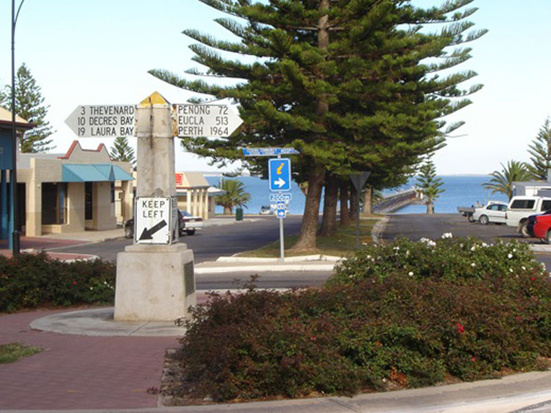
A small town in the West Coast region of South Australia that is the last major settlement before crossing the Nullarbor Plain from east to west. It is also the western gateway to the Eyre Peninsula and the south eastern reaches of the Great Australian Bight.
Where is it?: in the northwest corner of Eyre Peninsula, west of the junction of the Flinders and Eyre Highways around 786 km northwest of the capital Adelaide.
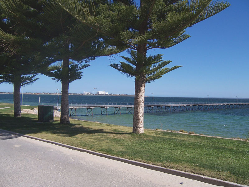
With a population of around 2,500, Ceduna is set on Murat Bay and the sandy coves, sheltered bays and offshore islands of the bay make it a popular base for a beach holiday. The foreshore at Ceduna is lined with Norfolk Island pine trees. There is a jetty for walking, fishing and small boats. The port town/suburb of Thevenard lies 3 km to the west on Cape Thevenard.

Ceduna was the site of a major satellite telecommunications facility operated by the Overseas Telecommunications Commission. Established by OTC in 1969 and later taken over by Telstra, this facility was a major employer in the town until it became redundant due to technological changes. The Earth Station provided the gateway between Australia and Europe for telephone and television communication. In October 1994, improved communication methods and a desire to rationalise services saw the closure of the Ceduna Earth Station. Tours to this site are not currently available, but you can travel via Goode Road for around 30 km to see the building and the one dish left there.
15km off the coast of Ceduna, Nuyts Archipelago Conservation Park comprises 22 islands and reefs and is a haven for rare and endangered wildlife. Accessible by boat, the islands feature granite boulders with limestone domes and large sand dunes. Mangrove communities can also be found on St Peter and Eyre islands with good access to fishing nearby. Access to the Franklin islands are prohibited, however boat tours operate to the other islands in the group out of Ceduna.
Take a leisurely drive 14 kms west, along the Denial Bay Road and look at McKenzie's ruins. William McKenzie was known as the father of the district, as it was he who encouraged many farmers to come here to start a new life. At aged 45, Wiliam went to Denial Bay and selected 16,280 ha of land. He employed a large number of men and women on his farm and his farming example created a pilgrimage to Denial Bay and districts. It was not unusual to see up to 20 four-foot strippers reaping in his paddocks.
European contact with the coast near Ceduna began in the early 17th century, 166 years before the establishment of the first European settlement on Sydney Harbour, when the islands offshore were first charted.
In 1622 that the Governor General of Dutch East Indies, Jan Pieterszoon Coen, made plans and gave instructions for a thorough investigation of the South Land. He wanted 'to ascertaining as much of the situation and nature of these regions as God Almighty shall vouchsafe to allow'.
In 1627 the crew of the Gulden Zeepaert, under the command of Francois Thijssen, touched the most southerly part of the continent and sailed east as far as present day Ceduna. 1,800 km of Australia's south coast were traversed and mapped, between Cape Leeuwin and Nuyts Archipelago. The land was named Pieter Nuytsland, after one of the 220 passengers on board, Pieter Nuyts, an esteemed councillor of India who planned to settle in Java.
Two of the islands discovered were named St Peter and St Francis on what became Australia Day (26th January) 1627. Later, French explorer Nicolas Baudin and English navigator Matthew Flinders praised the accuracy of the Dutch mapping, the first of any part of the southern coast of the Australian continent. They are now the oldest place names in South Australia. Not finding anything of their liking or to trade, most of the Dutch navigators soon lost interest in New Holland and gave no further thought of colonising it or establishing a small foothold or port.
Matthew Flinders on his voyage in the Investigator, anchored in Fowlers Bay on 28 January 1802. He went on to explore the coast and named Denial Bay, Smoky Bay and the islands of Nuyts Archipelago. He was disappointed to find no river and gave the name Denial Bay because they did not find fresh water. French expedition leader Nicolas Baudin visited Murat Bay after meeting with Flinders and named it after Joachim Murat. He also named the point of Thevenard after the Admiral and Minister of Marine Antoine-Jean-Marie Thevenard, and Decres Bay after Denis Decres, duke of the First French Empire.
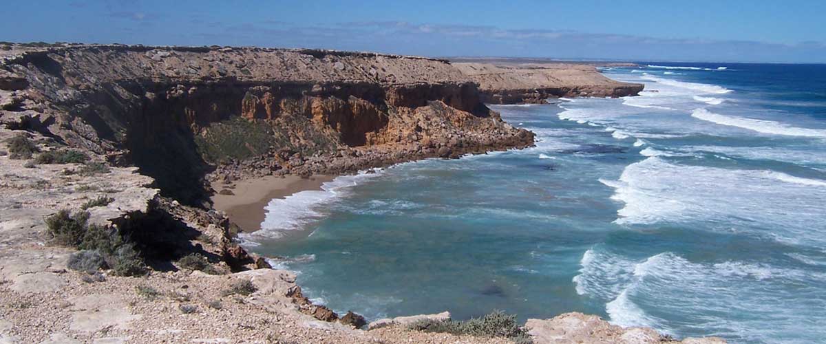
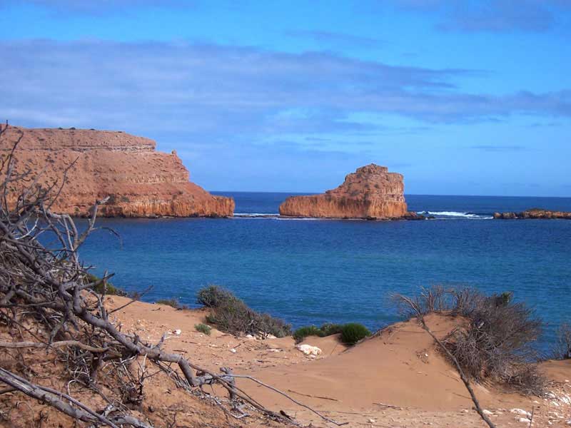
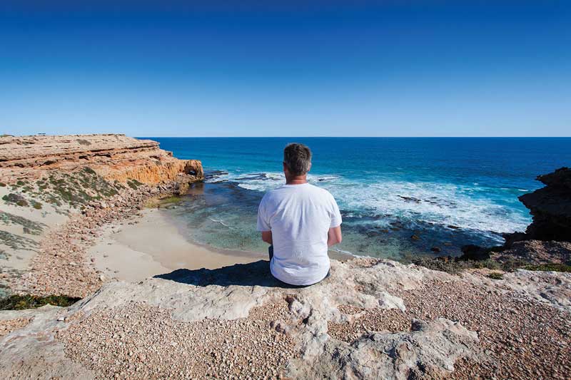
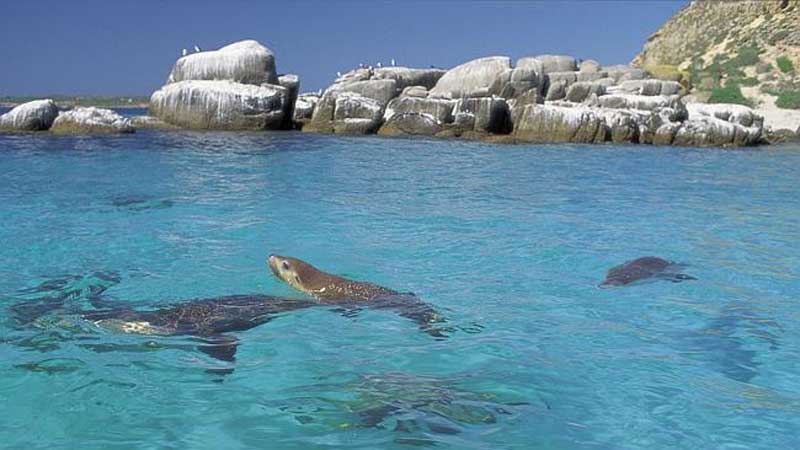
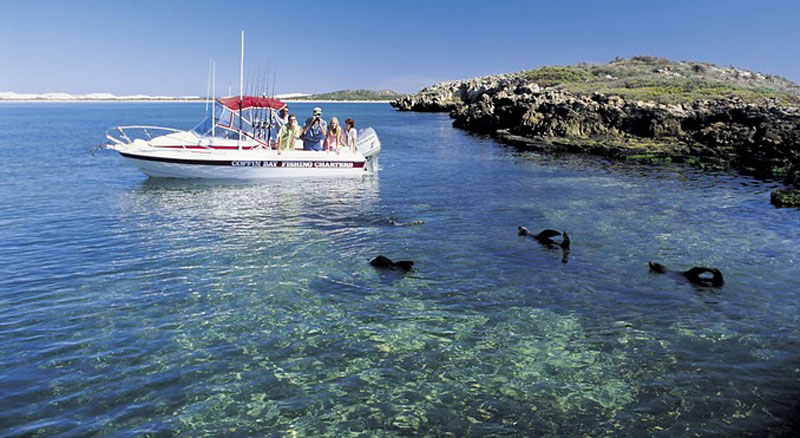
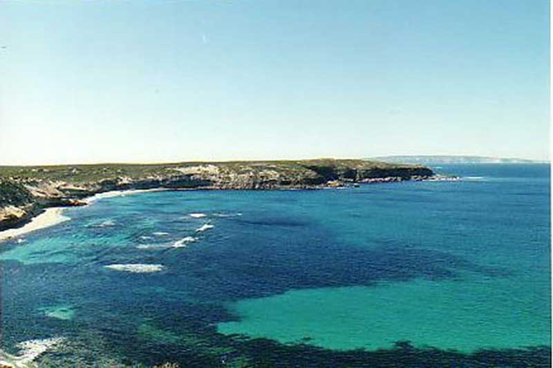
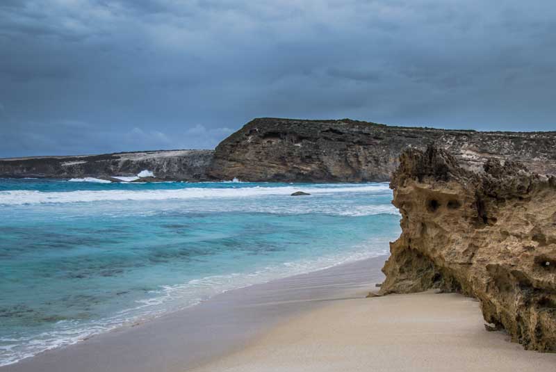
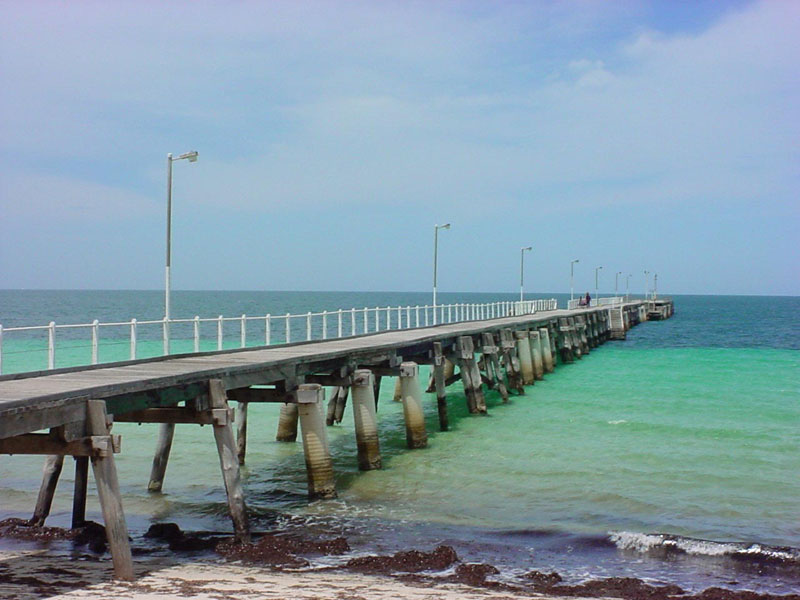
Travelling south from Ceduna, the first town you come to is Streaky Bay, a very laid back, friendly place that is the kicking off point for another road less travelled that is so good - The Westall Way. Along it are some quite striking coastal cliffs and the highlight for me - the only accessible permanent colony of Australian Sea-lions on the Australian coast at Pt. Labatt.
A holiday resort, fishing port and service town for the neighbouring cereal growing farmlands. It is situated on a scenic coastline and is the only safe deepwater harbour between Port Lincoln and King George Sound in Western Australia. Hundreds of anglers flocking to the area to sample the renowned whiting. King George whiting, Snapper and Blue Swimmer Crabs are the most commonly targeted species, with many more available. Other activities include hiking, surfing, snorkelling and scuba diving, with guided charters being available.
Where is it?: Eyre Peninsula. 727 km north west of Adelaide; 303 km north north west of Port Lincoln.
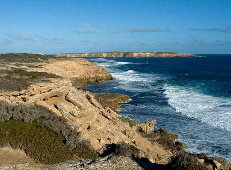
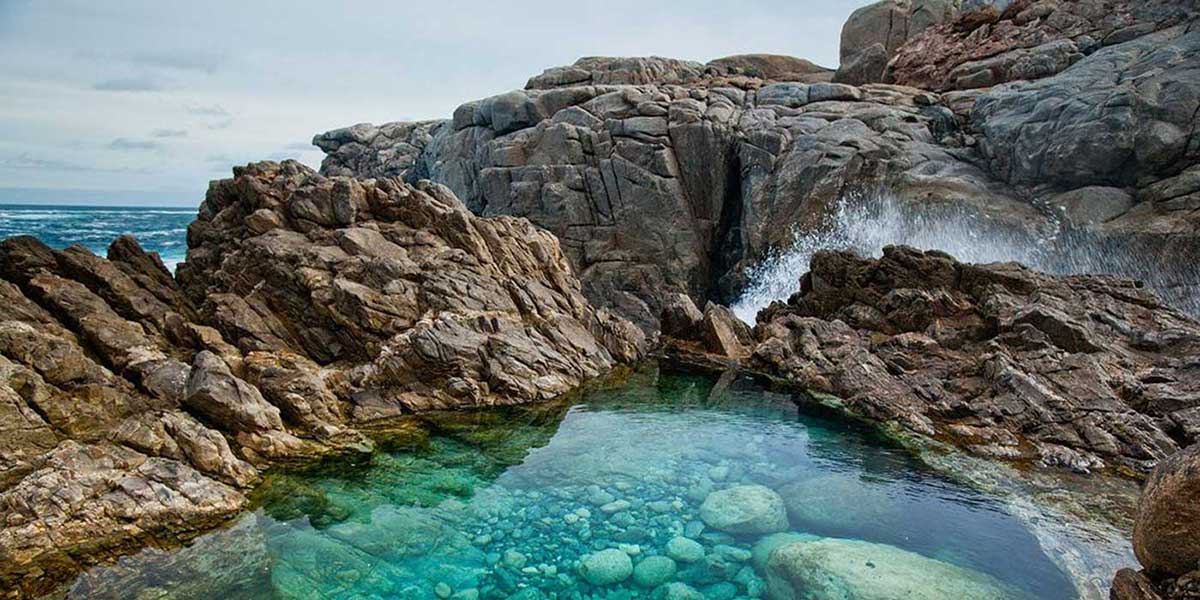
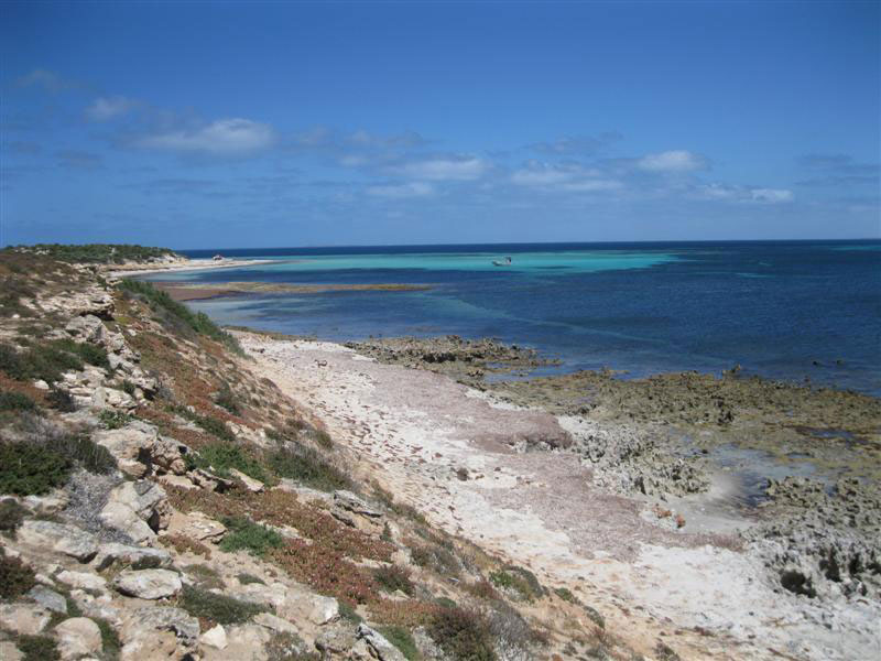
The features that most commonly draw tourists are along the immense stretch of coastline surrounding the bay. The Bay itself is relatively protected and quiet stretches of beach can be found along most of its length. However, where the coastline is exposed to the swells of the Southern Ocean, cliffs are exposed, along with sheltered areas that harbour large rockpools, such as Smooth Pool and The Granites.
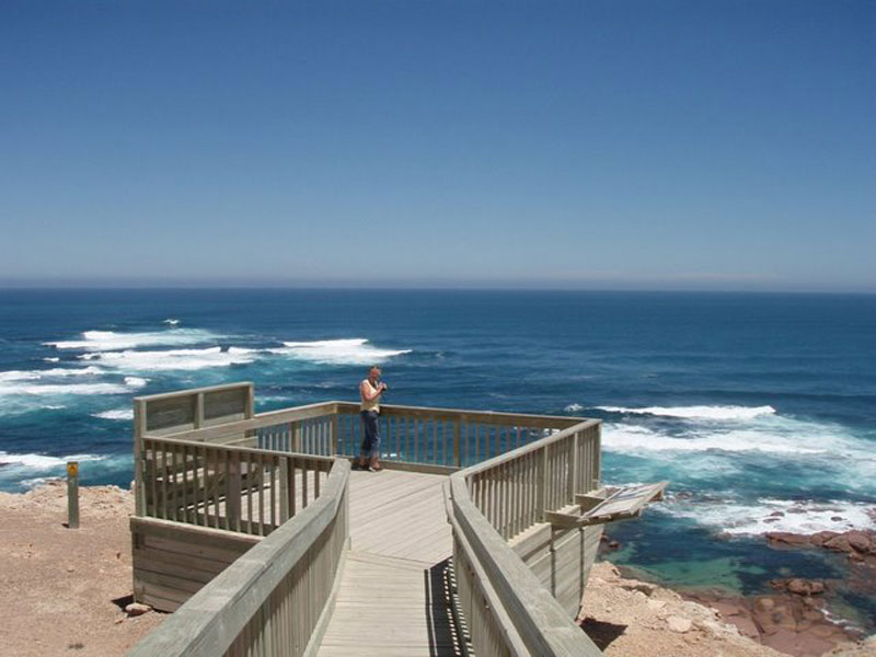
Point Labatt is on the Westall Way coastal drive. Here a viewing platform has been erected on the cliffs directly above Australia's only mainland sea-lion colony. Interpretive signs explain about these sea creatures. The reefs at the foot of the cliffs provide a resting place for the sea-lions, which have often spent several weeks at sea catching fish. Point Labatt has exposed headlands, sheltered bays and is known for bird life including the Osprey and the Whitebellied Sea-eagle.
Point Labatt Conservation Park is home to the only permanent colony of Australian sea-lions on mainland Australia and offers a unique opportunity to observe these rare and endangered marine mammals. To help protect the animals natural habitat, camping and access to the aquatic reserve below is prohibited. As the cliff top viewing area is exposed, it’s a good idea to bring a warm or wind proof jacket.
High Cliff, Corvisart Bay
A short coastal drive, Westall Way is one of the Eyre Peninsula's best kept secrets, a showcase for an amazing variety of landforms and seascapes. Dotted along Westall Way are rugged limestone cliffs, granite boulders covered in golden lichen, secluded granite pools and quite striking seascapes with foaming white breakers. In stark contrast are the huge white Yanerbie sand dunes. At Point Labatt, visitors are treated to a bird's eye view of Australia's only mainland sea-lion colony built high above the colony on the edge of the cliffs.
The next town you come to is Port Kenny. The short drive out to the fishing village of Venus Bay is well worth the effort. The coastal scenery is quite different to the Westall Way, but equally as stark and picturesque. Dolphins are often seen frolicking in the waters at the head of Venus Bay.
A small tourist and fishing town, Port Kenny can serve as a base for exploring the surrounding agricultural district, as well as professional fishermen.
Where is it?: Eyre Peninsula. 655 km west of Adelaide; 61 km south east of Streaky Bay; 231 km north west of Port Lincoln.
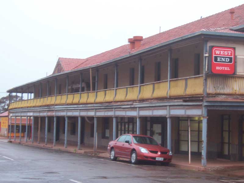
Port Kenny was surveyed in 1912, with Governor Bosanquet naming the town after a local landholder. The town grew slightly with the opening of a local hall in 1934, and then the hotel in 1939. Very little has occurred since these buildings were erected, although the town was pivotal in handling the grain and wool which was produced in the hinterland, with grain still being shipped from Port Kenny until the late 1950s. Port Kenny and Venus Bay have survived because during the early part of this century they were important (if very small) ports. As early as the late 1920s the area had been discovered by recreational fishermen who travelled to these tiny outposts eager to catch trevally and trout.
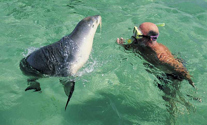
An excellent fishing spot located about 15 km from the Port Kenny Township. The bay's other attraction is a colony of sea lions. This protected bay is fast becoming a 'must do' holiday experience for travellers. Guided tours are available - the Nocturnal Wildlife tour, the Star Gazers delight and the Sea Lion and Dolphin tour. Unfed, untrained and totally wild sea lions and bottlenose dolphins often chose to interact with swimmers on these tours.
To experience the real drama of this very dramatic coast it is necessary to travel south 18 km from Port Kenny to the tiny town of Talia. Here is another forgotten little settlement. Talia was surveyed in 1882. The school opened in 1889 and the local hall was built in 1895. Looking at the town today it is hard to imagine that as late as the 1940s Talia was a thriving settlement.
6 km out of Talia (on a road which runs from the town across to the coast) are the famous Talia Caves, which are more accurately described as eroded limestone caverns in the cliff face created by weathering and erosion over thousands of years. Woolshed Ave is reached by a relatively easy walking track. The Woolshed is a large cave, or cavity, in the cliff face which has been formed by the erosion of the cliff face by wind and water.
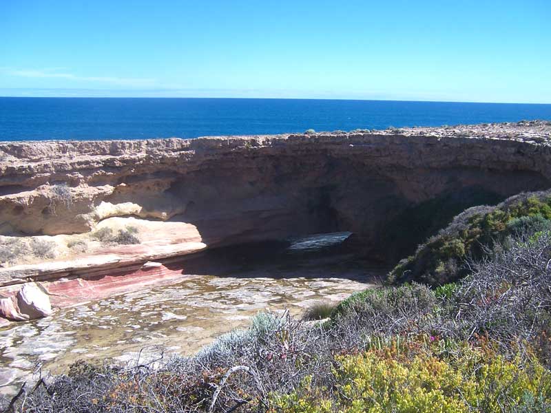
The second cave, known as The Tub, is a collapsed limestone crater. It is possible to climb into The Tub. The ocean access to the area is through a tunnel in the rocks. Beyond The Tub is a dramatic cliff face which offers views for kilometres to the south along the Talia beach.
This lonely and dramatic beach looks dangerous and, as if to confirm this initial impression, there is a substantial marble monument to a Sister Millard who lost her life on 24 June 1924 when part of the cliff face collapsed. Her story is a reminder of the dangers of these cliffs. The day before her death she had resigned from Ceduna Hospital. With three friends she travelled down the coast to have a picnic on the cliffs. While she was taking a photograph the cliff collapsed and she fell into the sea. Her companions watched helplessly as she struggled to keep afloat. There was nothing they could do to save her.
Venus Bay is a small tourist and fishing town, its population numbers in the twenties during most of the year, but greatly increases during the summer holidays. The town also serves as an offloading point for professional fishermen, who fish the remote Archipelagos in the Southern Ocean.
Where is it?: Eyre Peninsula. 665 km west of Adelaide; 187 km south east of Ceduna; 76 km south of Streaky Bay.
Venus Bay is primarily a fishing and water sport based destination, with the sheltered waters providing small boat users a safe fishing environment. The bay is known to hold whiting, salmon, garfish, snook, tommy ruff, flathead and gummy shark.
The town lookout offers breathtaking views of towering cliffs and booming surf rolling in from the Great Australian Bight. Keen board riders can also view surf conditions of nearby surf beaches from here.

The first settlement in the area was that at Venus Bay where a whaling station was established in the 1820s. The tiny settlement consisting of a shop, hotel and police station operated until the 1840s. After that time the focus of the settlement turned inland as the surrounding area was opened up for grazing in 1840s and cereal cropping in the 1870s. The township was abandoned by 1900. It was somewhat revitalised in the 1920s when it became a base for a commercial fishing operation.

Cape Finniss lookout
Upon reching Cape Finniss the coastal vistas have changed again; take the coastal side road if you can find it, as the scenery and views are quite superb.
Elliston is a small coastal town which is a fishing port and the centre for a cereal growing and mixed farming agricultural district. It is known for its rugged, scenic coastline. Set between rolling and pleasant sheep and wheat country and some of the most interesting and dramatic coastline on the Eyre Peninsula the town has little of historical interest but is a pleasant place for fishing, swimming, surfing and walking along the rugged sandstone cliffs.
Where is it?: Eyre Peninsula. 169 km northwest of Port Lincoln; 641 km west of Adelaide via the Princes and Eyre Highways.
Elliston stands on the shores of Waterloo Bay which, although it was used to ship out local produce and bring in supplies, has a hair-raisingly dangerous entry with reefs lying between the two headlands - Wellington and Wellesley Points. It is on these headlands that the unusual clog-shaped fossilised cocoons of the weevil Leptopius duponti, which are reputed to be over 100,000 years old, can be seen.
Elliston is one of the very few towns in Australia to boast that it has been named after a writer. Originally known as Ellie's Town it was named after the writer and teacher Ellen Liston who was born in England in 1838 and emigrated to South Australia in 1850. She became a governess and was working on the property owned by John Hamp near the present town when Governor Sir William Francis Drummond Jervois decided to name the town after her. The honour was a combination of the wide spread respect and admiration she enjoyed in the area and Jervois' penchant for naming towns after friends and family. Ellie's Town was officially gazetted in 1878.
To the north of the town lies Anxious Bay (it can be reached by taking the road approximately 2 km north of the town) which offers spectacular cliff top views as well as access to the area known as 'Blackfellows' which is reputed to be one of the best surfing places on the Australian coast. King George whiting and crayfish are just some of the catch from this clean and unspoilt bay. Anxious Bay is appropriately named – we recommend you seek local advice on boating sizes and conditions before you venture out.
From the lookout take in the superb view of the outlying islands, including Top Gallant Isles, Flinders Island, Pearson Island and part of Waldegrave Island. Bird Rock, Waterloo Bay and the Elliston township and silos with farmland beyond can also be seen from the lookout.
The Investigator Group is an archipelago of islands consisting of Flinders Island and five island groups located off the western coast of the Eyre Peninsula. It is named after HMS Investigator by her commander, Matthew Flinders. He named the island group after William Waldegrave, 1st Baron Radstock on Wednesday, 10 February 1802. Waldegrave was the Governor of Newfoundland and an Admiral in the Royal Navy. It is a coincidence that there is also a town named Ellison on Canada's Newfoumndland coast, which is known for its wildlife, including seals, puffins and fairy penguins.
The Group lies within the Great Australian Bight. All the islands except Flinders Island are within the Investigator Group Wilderness Protection Area and the Waldegrave Islands Conservation Park.
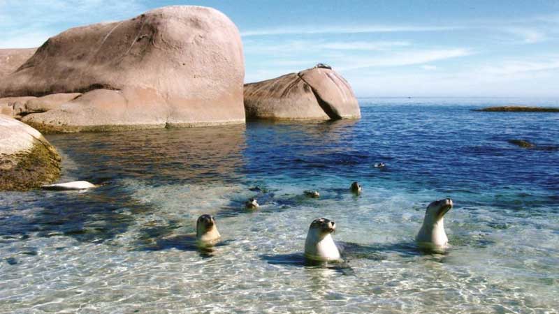
The northernmost group - the Waldegrave Islands - lies 3 km offshore near the small town of Elliston. The Waldegrave Islands Conservation Park occupies Waldegrave Island, Little Waldegrave Island and the Watchers. They were grazed by sheep until 1967. Waldegrave Islands Conservation Park is a sanctuary for Cape Barren geese, fairy penguins, sea lions and other wildlife. The Waldegrave Islands were considered to be the ’second most important breeding area’ for Cape Barren geese in South Australia, and are also the site of a little penguin breeding colony. Little Waldegrave Island is the site of a breeding colony of Australian sea lion.
After the fishing village of Elliston, the next major coastal feature worth going off the beaten track for is Coffin Bay. There are a long of great walking tracks in Coffin Bay National Park that are well worth taking if you have the time and love bushwalking.
The village of Coffin Bay is an unspoilt centre for holidays and fishing near the tip of Eyre Peninsula, on its western side.
Where is it?: Eyre Peninsula. 703 km west of Adelaide; 47 km west of Port Lincoln.
Coffin Bay is a typical isolated holiday settlement full of holiday units and relatively cheap accommodation and designed for people who want to spend a holiday fishing, sailing, skindiving, bushwalking or enjoying themselves on the beach. The surrounding area is spectacularly beautiful and some of the out-of-the-way places like Gallipoli Beach, Farm Beach and the Coffin Bay Peninsula are genuinely fascinating.
Coffin Bay is widely regarded as the best place in Australia to grow oysters. The bay's sequestered waters are unsullied by rivers or drains, while the cold Southern Ocean provides a nutrient-rich tonic for hungry molluscs. Coffin Bay produces tens of thousands of oysters every week, being 60 per cent of the South Australian total.
The Coffin Bay area has a reputation as a haven for fishermen. Consequently everyone from rock fishermen, to surf fishermen, people keen to fish from boats, and jetty fishermen (there are special fishing jetties near Coffin Bay township at Crinolin Point and Schnapper Point) are all attracted to the area. Fish caught in the area include whiting, salmon, trevally, garfish, tommy ruffs, snapper and flathead. The Enjoy Coffin Bay brochure available around town provides details about the kind of fishing available around the bay.
The road from Wangary to Farm Beach passes a turnoff to Dutton Bay where an old woolshed and restored jetty stand as reminders of an era when this entire stretch of coastline was privately leased to Price Maurice, who built the woolshed in 1875 utilising local stone and wooden trusses from Oregon in the United States. It is estimated that over 20 000 sheep were shorn each year at the woolshed's peak of activity with the fleeces shipped from the jetty to overseas markets.
A trip out to Point Avoid and Yangie Bay is highly recommended. The views of the rugged and lonely beaches on the western shoreline of the park and the dramatic view across Coffin Bay from Yangie Bay lookout point are truly breathtaking. The size of the huge sand dunes in the area (some are over 100 metres high) bears grim witness to the seas, driven by the Roaring Forties and uninterrupted on their journey across the Great Australian Bight, which batter this section of the Australian coast.
At the south end of Farm Beach, just near the main boat launching point, is a rough dirt road which leads to the beach where the invasion scenes in the movie Gallipoli, starring Mel Gibson, was filmed. Unfortunately all of the trenches, sandbags and the dugouts have been removed. They could have become a major tourist attraction in the area had the local council put a little more thought into it. The only thing left to see is a bay which approximates to the famous shoreline where the ANZACs came ashore at Gallipoli.
The township of Coffin Bay is near the entrance to Coffin Bay National Park, which features a long peninsula with a sheltered bay, coastal dunes, swamps and a spectacular coastline of islands, reefs, limestone cliffs and white surf beaches. The Conservation Parks and National Parks in the area offer a rich variety of flora and fauna as well as a wide range of interesting bushwalks. There are breeding grounds for sea birds such as the reef heron, fairy penguins, cormorants, sooty oystercatchers, and crested and caspian terns. The flora includes the moonah tea-tree, cutting grass, the beautiful drooping she-oak and, in spring and summer, the parks are alive with the colours of the wildflowers which grow in profusion.
This peninsula located at the south east end of Eyre Peninsula. While parts of its surface have been cleared and used for agricultural purposes in the past, it is currently occupied by two protected areas: the Lincoln National Park and the Memory Cove Wilderness Protection Area. It is bounded by Proper Bay and Spalding Cove within the natural harbour known as Port Lincoln to the north, Spencer Gulf to the east and the Great Australian Bight to the south. While it was first explored and mapped by Matthew Flinders during February 1802, Flinders did not name it. In 1913, the name proposed by François Peron and Louis de Freycinet from Baudin’s expedition when it visited later in 1802 was declared as the peninsula's official name by the Government of South Australia. Jussieu refers to the French botanist, Antoine Laurent de Jussieu.
As the main town on the Eyre Peninsula, Port Lincoln plays a dual role as a major commercial centre for the south of the Peninsula, and a popular destination for visitors.
Where is it?: Eyre Peninsula. Located on the eastern shores of Eyre Peninsula, port Lincoln is 806 km by road (246 km by air) west of Adelaide.
More than just a pretty town overlooking Boston Bay, Port Lincoln sees itself as both the Seafood Capital of Australia and an ideal base from which to explore the coast and hinterland of the Lower Eyre Peninsula. It boasts Australia's largest commercial fishing fleet and fish farming has become so important that Port Lincoln now has kingfish farms, mussel farms, oyster farms, experimental lobster farms and abalone farms. It should never be underestimated that the anglers (predominantly of Italian ancestry) of Port Lincoln are very, very wealthy men. The money which can be made from tuna fishing verges on the fantastic.
Port Lincoln is a popular tourist destination, thanks to the scenic beauty and coastal locality. Ready access to both Spencer Gulf and the Great Australian Bight make Port Lincoln a blue water playground for yachting, scuba diving, shark cage diving and game fishing. It is the perfect base from which the explore the many natural attractions of southern Eyre Peninsula.
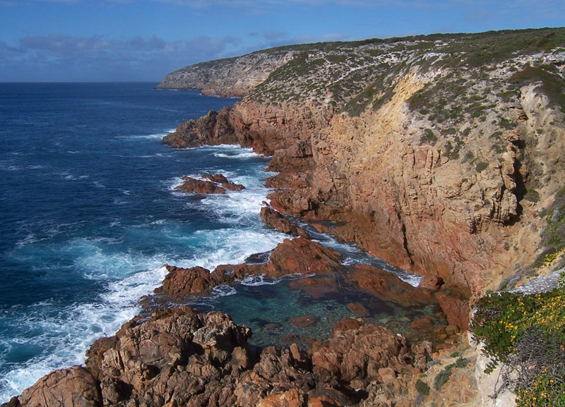
Lincoln National Park and a tourist drive on private property named Whalers Way give access to what I believe to be some of the most stunning coastal scenery in the country. Though this coastline looks nothing like say, Victoria's Shipwreck Coast, it is equally as breaktaking, and well worth the long drive to this fairly isolated corner of the continent.
Port Lincoln's aquatic links are celebrated in a series of annual festivals: Tunarama (spread out over four days around the Australia Day long weekend in January), the Lincoln Quin's Blue Water Classic Yacht Race in February, the Lincoln Week Regatta in March, the Mediterraneo Festival in April, and the Port Lincoln Game Fishing Club Tournament.
 Curta Rocks, Lincoln National Park
Best time to visit: Due to the insulating effect of the surrounding ocean waters, Port Lincoln experiences a delightful Mediterranean climate, which is on average a degree or two warmer than Adelaide in winter and 3 - 5 degrees cooler than Adelaide during the hot summer months. Port Lincoln's average rainfall is 488mm, which falls mainly during the winter months. Warm summers, mild winters and balmy weather during autumn and spring, make Port Lincoln an all year destination for touring, fishing, sailing and other recreational pursuits.
5 km offshore, between Port Lincoln and Cape Donington, is Boston Island. First sighted by Matthew Flinders in 1802 the island was settled as early as 1840 when an old slab cottage, which is still standing, was built. Today Boston Island Tours leave the town jetty, opposite the post office on Tasman Terrace. Boston Island creates a sheltered area within Boston Bay which is ideal for fishing, as well as sailing. Further north-east is the Sir Joseph Banks Group of Islands and to the south-east is Thorny Passage, both ideal for offshore anglers.
From Port Lincoln, you'll need to backtrack a bit to see what I consider to be one of the best bits of coastline in the country. Lincoln National Park, which covers most of Jussieu Peninsula to the south of Port Lincoln It has some unique natural features such as the vast Sleaford-Wanna dune system, offshore islands, and the outstanding wilderness of Memory Cove. With its undulating limestone hills, vast expanses of mallee woodland with occasional granite outcrops, sheltered coves, isolated sandy beaches and rugged cliffs, the Park can be explored by foot or vehicle.

Many geographical features about the peninsula bear names given to them by Matthew Flinders in 1802 when, in the Investigator, he explored and charted the southern coastline of Australia. A walk to the Flinders Monument vantage point on Stamford Hill, commands magnificent views over the rugged coast, surrounding bays, off-shore islands, and across the water to Port Lincoln.'
Although much of the park is accessible by conventional vehicle there are a number of 4WD roads including a superb drive out to Memory Cove which passes through land once cleared in a forlorn and unsuccessful attempt to farm the peninsula. This road also passes the limestone cliffs on the southern edge of the park. This is a wilderness area and entry is by key and permit from the Visitor Information Centre. Entry is restricted to 15 vehicles per day and there are 5 campsites which must be booked at the Visitor Centre.
Memory Cove, which was named by Flinders as a reminder of the tragic accident which took the lives of his eight crewmen, has a replica of a copper plate which Flinders left on a post. The original plate, which is now housed in the Adelaide Public Library, had the following inscription: 'Memory Cove. H.M.S. Investigator, M. Flinders Comr. anchored here on 22nd February 1802. Mr John Thistle, the Master, Mr William Taylor, Midn and six of the crew were most unfortunately drowned near this place from being upset in a boat. The wreck of the boat was found, but their bodies were not recovered.
 Sleaford Lookout, Lincoln National Park
A long-distance walking trail within Lincoln National Park. The trail takes its name from HMS Investigator, the ship commanded by Matthew Flinders while surveying the rugged coastline of Eyre Peninsula in 1802. The Investigator Trail is made up of sections which can be individually walked or hiked - or trekked as a whole. The Investigator Trail and other trails within the park are clearly defined and marked with checkpoints at strategic locations to orientate yourself.
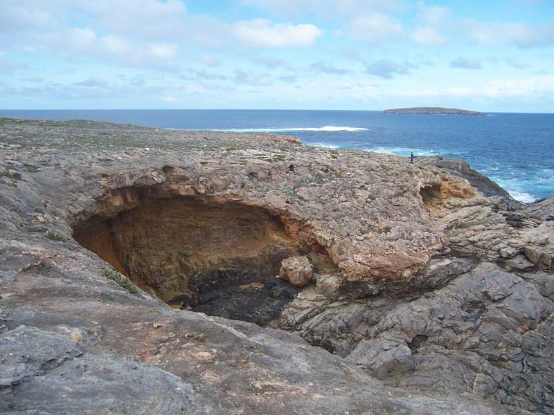
One of the most dramatic sections of coastline on the Australian mainland occurs on the promontory 32km to the south west of the town of Port Lincoln. It is accessed by The Whaler's Way, a series of unsealed tracks which pass through private property along its 14km length, give access to the area and its well sign-posted coastal features. These include numerous islands and a series of natural crevasses, giant fissures in the rocky coastline which have created deep bays and chasms in the rock into which the sea surges back and forth. These crevasses are of varying depths, lengths and widths.
For a small fee payable at the visitors centre in Port Lincoln, you get a gate key for access and a map pointing out all the highlights, with a little story about each. There are over 20 stopping places at lookouts, cliffs, crevasses and offshore islands from Sleaford Bay to Cape Wiles, and then to Cape Carnot. The coastal scenery is quite stunning and you can easily spend the best part of a day taking it all in if you have the time.
Named by Matthew Flinders on 19th February 1802 after the botanist James Wiles who sailed with Flinders, Cape Wiles is a 100 metre high cliff face above the swirling sea, with pillars of rock and an island offering continuing resistance to the Southern Ocean. The island, which has been worn away through its middle by centuries of destructive tides, takes the form of two golden sandstone pyramids that stand defiantly against the pounding waves. Dozens of fur seals gamble in the water or bask on the rocks at this locality.
The most south-westerly tip of Eyre Peninsula, Cape Carnot was named by French explorer Nicolas Baudin on 6th April 1802, in honour of Lazare Carnot. Cape Carnot consists of two spectacular rocky promontories; the more westerly ends in a small Peninsula, roughly circular in shape, which contains some of the most significant exposures of early Proterozoic/ Archaean gneisses. The coastline is a dangerous one, subject to freak waves. The rocks constituting Cape Cornot are said to be amongst the oldest known in South Australia. They consist of granulites and gneisses showing folded layering.
From Port Lincoln, head north along the east coast of the peninsula. Tumby Bay is a quiet fishing village on the shores of Spencer Gulf that makes a quiet, peaceful alternative to Port Lincoln as a base for exploring the southern tip of Eyre Peninsula.
Where is it?: Eyre Peninsula. 49 km north of Port Lincoln; 301 km west of Adelaide via the Princes and Lincoln Highways.
The town's name is taken from the coastal feature on which it stands. The bay and nearby island was named by Matthew Flinders when he sailed the coast in March 1802. At this stage of his circumnavigatory voyage around Australia, Flinders was naming the coastal features he charted after localities in Lincolnshire, England, the county in which he was born. Tumby is a village in Lincolnshire.
Sir Joseph Banks Islands (22 km east), known to locals as "the Groups", offers a range of sheltered bays, golden sand beaches. The islands are all low-lying limestone capping granite platforms, which is often exposed along shorelines and in adjacent shallow and drying reefs. They are a breeding ground for a large variety of sea birds, seals, dolphins and fish, with the King George whiting and snapper the most sought after. The archipelago has breeding colonies for Australian Sea Lions and Cape Barren Geese. Spilsby Island is privately owned and continues to be grazed by sheep, as well as holding a few holiday cottages.
 Spilsby Island
One of the town's special attractions is a charter trip to the Sir Joseph Banks Islands which lie 12 nautical miles off the coast. The islands were originally used to graze sheep but today they are a conservation area where Southern Ocean birds such as Gape Barren geese and albatrosses as well as seals and porpoises can be seen. The islands were named by explorer Matthew Flinders in February 1802 after the famed botanist, Sir Joseph Banks (1743-1820), who accompanied Liet. James Cook on his voyage of discovery to the South Pacific and east coast of Australia in 1770.
Located 71.4 km north-east of Tumby Bay, the small town of Arno bay sits on the Spencer Gulf. The town itself lies on the bay of the same name, which is dominated by a mixture of white, sandy beaches, cliffs, and mangrove systems. Tourism is now one of the largest components of the town's economy. A boat ramp is located in the town, with whiting, snapper, tommy ruff, garfish, salmon and may other popular species caught in the bay, with most of these also available off the town jetty and beach. For boat anglers, the 'Redbanks' region has been known to produce large Mulloway and Snapper, as well as offering scenery in the form of the imposing cliffs. The local aquaculture industry also promotes tourism, with tours through facilities where finfish are raised.
The coastal town of Cowell, on Franklin Harbor, lies 153 km north-east of Port Lincoln and 92 km south of the major town of Whyalla. The town is the major population centre of the District Council of Franklin Harbour, and the centre of an agricultural district, farming wheat and sheep. Fishing, and more recently, oyster farming has also been an important industry. The Franklin Harbour Historical Museum, situated in the old post office residence in Main Street, Cowell preserves many historically important artefacts of the region, both natural and manmade.
Tourism is an important economic drive for the town, with tourists flocking to the area at Easter and over the summer holidays. Fishing for many species including King George and Silver whiting, Garfish, Mullet, Flathead, Snapper, Tommy Ruff, Snook, Yellowfin Whiting, squid and crabs is very popular, with other forms of water sport available further up the coastline.
16 km away, on Spencer Gulf, is the port town of Lucky Bay. A passenger and car ferry operates across Spencer Gulf between Lucky Bay and Wallaroo on Yorke Peninsula. The ship sails under the Spencer Gulf Searoad business name.
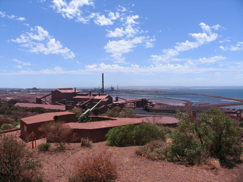
74 km south of Port Augusta is the former BHP company town of Whyalla. The maritime museum's prize exhibit is the navy vessel HMAS Whyalla, which was built here in 1941. The vessel is on blocks and is open for inspection. Whyalla is South Australia's second largest city and once a major industrial force with an iron ore smelter, steel rolling mill and shipyard. It is a large, sad sort of place that has spent many years struggling for survival - reddened, like a bruised eye, by the iron ore which is blown over the city from the steelworks. Driven by the local steel and petroleum industries, Whyalla has refused to die, and is still the largest provincial city in South Australia.
 Abandoned hotel in the city centre, 2008
Where is it?: Eyre Peninsula. 395 km north west of Adelaide; 76 km south of Port Augusta, on the east coast of Eyre Peninsula
Hummock Hill is the ideal place to get an overall perspective of the city. It looks over BHP's Pellet Plant to the north, across the marina to the east, down the coast to the south and across the city centre to the west. Hummock Hill was used as an observation post during World War II and the gun emplacements are still standing. On the southern slope of Hummock Hill, near the beach, are the Ada Ryan Gardens. This pleasant green park, complete with a duck pond and some native fauna, is a cool retreat from the hot dryness (the town boast 301 sunny days and only 268mm annual rainfall) of the town.
 Whyalla shipbuilding yard, 1970
Between 1941-78 sixty-three ships were built at the Whyalla shipyard. At its peak Whyalla was the biggest shipbuilding port in Australia with a capacity to build ships up to 83,000 tonnes. The largest ship ever built in Australia, a bulk carrier called the Clutha Capricorn, was launched from the Whyalla shipyards in 1972. The most memorable was the ore carrier, MV Lake Illawarra, which collided with the Tasman Bridge in Hobart, Tasmania, on 5th January 1975, causing the deaths of 12 people. The ship and the debris pile were deemed unsafe to move, and remain at the bottom of the Derwent estuary.
 HMAS Whyalla, Whyalla Maritime Museum
Whyalla Maritime Museum has an excellent and comprehensive display, combines a history of local shipping (through models, photographs and audio visual displays) with a guided tour of the 650 tonne corvette HMAS Whyalla (the first ship built at Whyalla) and a huge model railway display.
Of all the ships built in Whyalla, the 650 tonne corvette HMAS Whyalla, the first ship completed at the shipyard, has become the most famous. It now stands like some kind of strange vessel which has lost its way glaring down over the Lincoln Highway at the northern entrance to the city.
Two kilometres beyond the Santos Plant is the Point Lowly Lighthouse which dates from 1883. It was originally built in masonry and extended in concrete. The original lantern is still in place. The lighthouse was manned until 1973 (the two lighthouse keeper's cottages are nearby) but is now fully automatic.
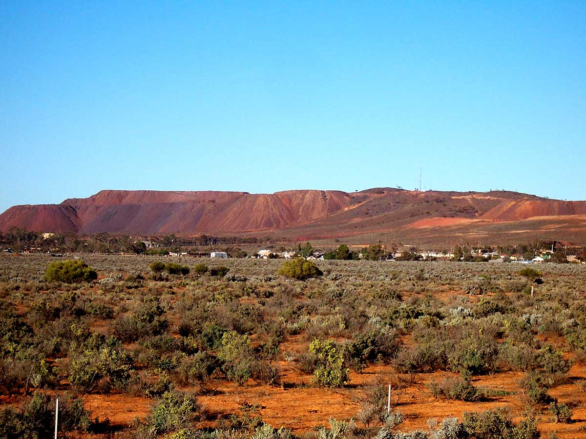
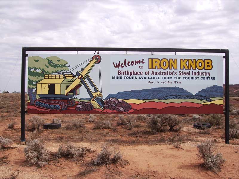
Just before re-joining Eyre Highway are Australia's oldest iron ore mines of Iron Knob and Iron Baron. The once thriving community of Iron Knob is all but a ghost town these days, but the few who have stayed on run a museum telling of the mine's and town's histories that is well worth seeing. They are proud of the town's heritage and have plenty of fascinating tales to tell.
Where is it?: Eyre Peninsula. 68 km west of Port Augusta, 52 km northwest of Whyalla. 152 m above sea level
Iron Knob is widely recognised as the first commercial iron ore mine in Australia. It was first exploited by Mount Minden Mining in 1880 but they couldn't keep up production or pay the rent and it was taken over by BHP who have run it continuously since 1899. BHP took over the lease in 1896 and started mining in 1899 when their smelters at Port Pirie required ironstone as a flux to smelt the silver-lead ores from Broken Hill. At the time, and really until the discovery of the huge iron reserves in the Pilbara region of Western Australia, the Iron Knob deposit was the largest in Australia. Until the 1960s all of BHP's major steelmaking operations - at Newcastle, Port Kembla, Port Pirie and Whyalla - were supplied with iron ore from the Iron Knob area.
It is not a particularly attractive town but what it lacks in savoir faire it makes up for in genuine interest. In recent years, as BHP have run their mining operations down in the area (there are now only 70 men working the mines at Iron Knob and Iron Monarch), the town (which was once administered by BHP) has been handed back to the local residents and they have had to deal with the complexities of local government and the establishment of revenue raising activities so that local services can be maintained.
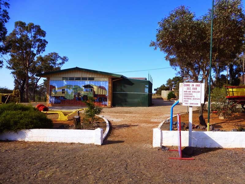
Iron Knob tourist centre and Mining Museum is about all there is for visitors to see in the town, but it is well worth a visit. The enthusiastic locals who man the place are eager to share the story of their town and the history of iron ore mining in the local region.
The Middleback Ranges - Iron Princess, Iron Monarch and Iron Knob - are all one and the same in the sense that they are all connected to the town of Iron Knob but Iron Monarch is nothing more than a mine (without a community) and Iron Princess is a small mine located between Iron Knob and Corunna Station.
Port Augusta, dubbed "the Gateway to the Outback", is also known as the "Crossroads of Australia", being situated on the major east-west highway connecting Perth and Sydney, and also the north-south highway connecting Adelaide and Darwin, as well as the beginning of Lincoln Highway around Eyre Peninsula at its Adelaide end. It also lies on the routes of both the Indian-Pacific and the Ghan. Consequently it is said that most people visit Port Augusta on their way somewhere else.
Spencer Gulf (only a few hundred metres wide at this point) divides the west and east of the town with the city centre and main commercial street on the east side with its commercial buildings, banks, shops, supermarkets and small malls.
A step up from your average country town museum, the Wadlata Outback Centre is an interesting exploration of the Aboriginal and European history of outback Australia. Restored railway carriages, interactive exhibits, and several movie productions. Allow at least an 90 minutes to experience it.


Design by W3layouts