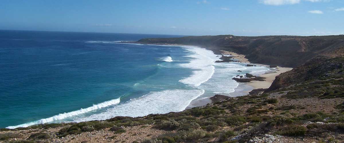
A short coastal drive, Westall Way is one of the Eyre Peninsula's best kept secrets, a showcase for an amazing variety of landforms and seascapes. Dotted along Westall Way are rugged limestone cliffs, granite boulders covered in golden lichen, secluded granite pools and quite striking seascapes with foaming white breakers. In stark contrast are the huge white Yanerbie sand dunes. At Pt. Labatt, visitors are treated to a bird's eye view of Australia's only mainland sea-lion colony.
Location: Streaky Bay, Eyre Peninsula, SA
Length: 80 km
Suggested return journey: taking the drive as part of the journey between Ceduna and Port Lincoln, the journey from Streaky Bay to Flinders Hwy near Murphy's Haystacks is 80 kms. If you are based in Streaky Bay, return to Streaky Bay via Flinders Hwy (38 km).
Features/attractions: Yanerbie sandhills; Pt. Westall; Pt. Labatt sea-lion colony viewing platform
Minimum duration (one way): 1 hour 30 mins.
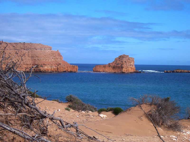
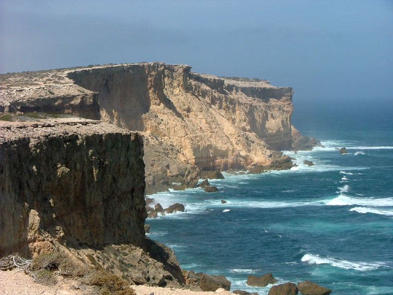
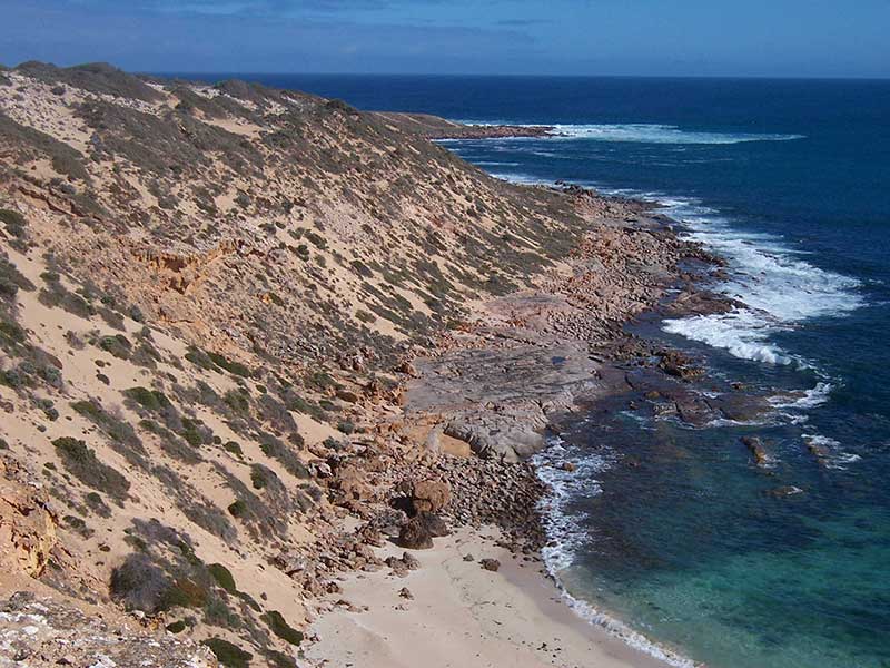
High Cliffs, Corvisart Bay
Without doubt, Westall Way - a scenic drive commencing from Streaky Bay - is one of the Eyre Peninsula's best kept secrets and a boon for travellers who have just crossed or who are about to cross the Nullarbor Plain. Before commencing a journey along the Westall Way, the short drive from Streaky Bay to Cape Bauer is recommended. Matthew Flinders named Cape Bauer, Streaky Bay, after his Austrian botanical artist, Lucas Ferdinand Bauer, who produced some 2000 drawings on the Flinders' ship, HMS Investigator.
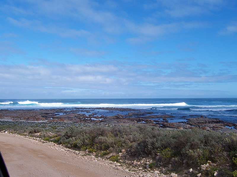
Dotted along Westall Way are rugged limestone cliffs, striking granite boulders covered in golden lichens, secluded granite pools and striking seascapes with foaming white breakers. Visiting Pt Westall, Corvisart Bay, the huge white Yanerbie sandhills, Tractor Beach, High Cliff, the Dreadnoughts, the Granites, Smooth Pool, Fishermans Paradise and Speeds Point, visitors often see White Sea Eagles who have made their territory in the area. A walking trail leads from Tractor Beach to High cliff.
Smooth Pool
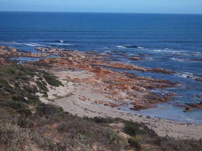
The Granites offers sweeping views to High Cliff and The Dreadnoughts. Its secluded granite rock pool with breaking seas in the background is picture postcard material. Smooth Pool is an excellent picnicking spot with magnificent blue water and breaking waves making the area a seascape photographer's paradise. Smooth Pool itself is an eroding granite shelf that faces the full force of local westerly weather systems. The outcrop extends for several hundreds of meters and at low tide the area is studded with rock pools, some two metres deep. Beachcombers will find crabs, small fish, seaweeds, barnacles and the odd starfish living in intertidal pools.
The Granites
Sceale Bay (pronounced Scale) is a small holiday and retirement town 32 kilometres south of Streaky Bay. The permanent population of 28 can double or treble at holiday times. The town was proclaimed as the township of Yanera in October 1888, but having been earlier named Sceale Bay by Captain Bloomfield Douglas of the Royal Navy, most people continued calling it by that name, and Yanera was offically renamed Sceale Bay in 1940.
Point Labatt
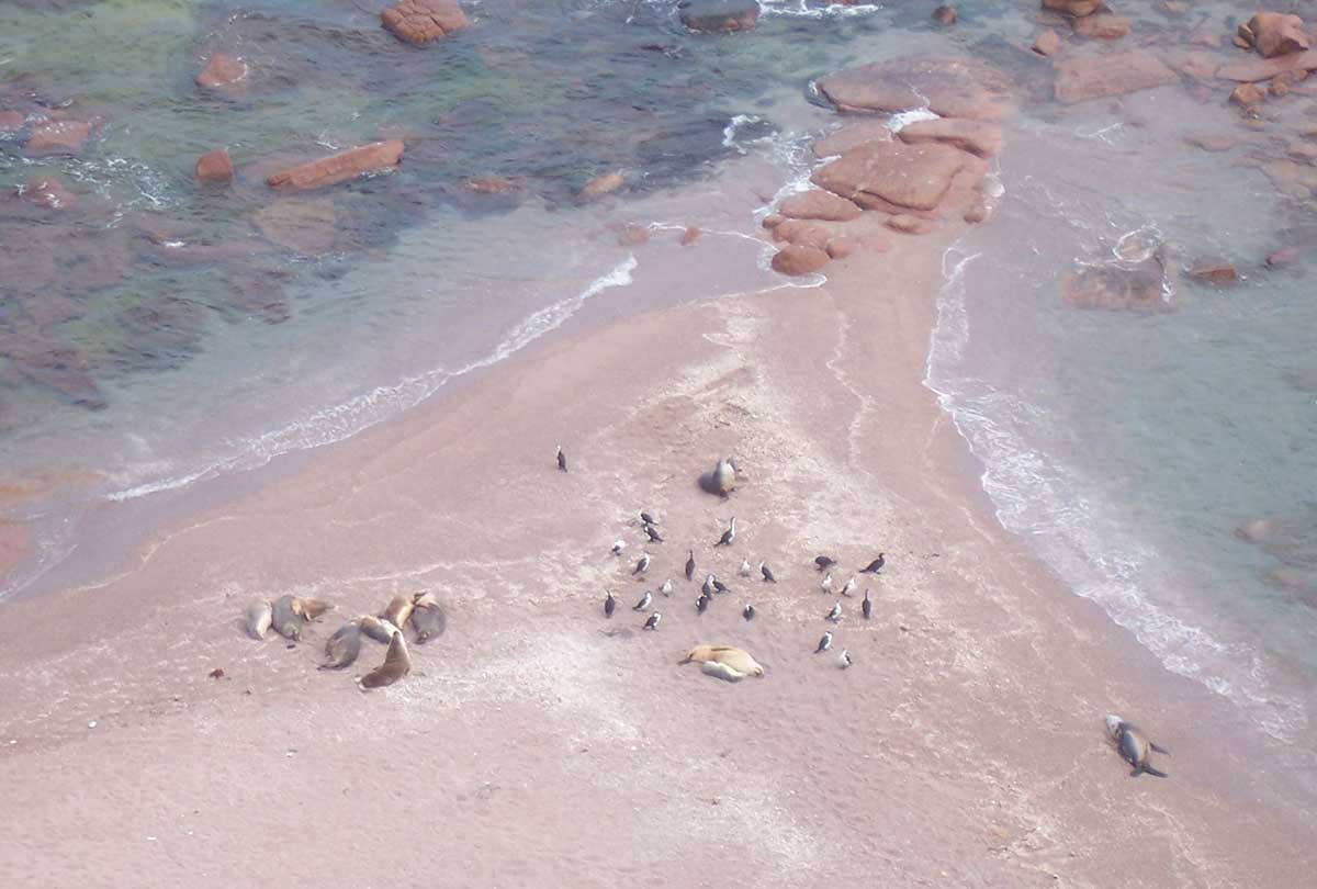
Sceale Bay offers good fishing, beautiful beaches and excellent surf. It is also close to the magnificient granite rock formation known as Murphy's Haystacks and Point Labatt Conservation Park, the home of Australia's only permanent mainland colony of Australian Sea-lions. Protected by cliffs and rocky reefs out to sea, the breeding colony is visible from a cliff top viewing platform immediately above it.
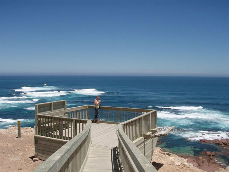
This wind-swept platform gives visitors a bird's eye view of the Sea-lions which are mostly seen sleeping on the beach. This is because they spend several weeks at sea fishing before hauling out to sleep for several days. These fascinating animals - Australia's only permanent mainland colony - can be seen in their natural habitat from a clifftop viewing platform. The reefs around the foot of the cliffs here provide a resting place for the sea-lions, which have often spent several weeks at sea catching fish before returning here to rest and play.
Point Labatt
The cliff top viewing area about 50 metres above the colony provides a view of the sea-lions and other coastal wildlife. Binoculars and/or a telephoto lens are recommended for enhanced viewing. Point Labatt has exposed headlands, sheltered bays and is also known for bird life including the Osprey and the Whitebellied Sea-eagle. The Point Labatt Conservation Park was dedicated to protect the sea-lion colony. The Aquatic Reserve below the cliffs is a prohibited area. Penalties apply for illegal entry into the Aquatic Reserve.
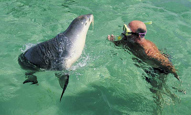
Baird Bay
Further south beyond Cape Radstock, Baird Bay offers a total change of scenery. Baird Bay is the shallow western arm of Anxious Bay, which Matthew Flinders was unable to see even from the topmast in 1802. The total area of the bay covers about 3,800 hectares with a beautiful sweeping beach in the town's foreground. Flinders saw only the mouth with its small island (now Jones Island). The bay was named after one of the area's early sheep graziers, James Baird.
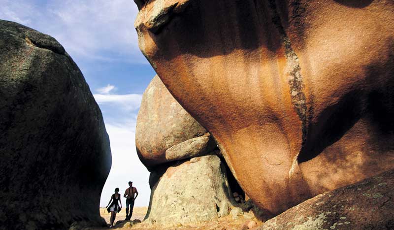
Murphy's Haystacks
Return almost to Sceale Bay, taking the road to the right to Flinders Highway and Murphy's Haystacks, our next point of interest. Murphy's Haystacks are not haystacks at all but a clump of pink granite boulders that give the appearance of haystacks. These lone sentinels on the hillside were formed from ancient granite inselbergs dating back 1,500 million years. (The name inselberg comes from German insel, meaning island and berg, mountain). The pillars and boulders in their present day form only go back as far as 100,000 years and have been formed by the uneven weathering of crystalline rock as densely fractured compartments break down through weathering more quickly than massive unfractured compartments. The granite hills of the district, including the haystacks, were buried by calcareous dune sand about 30,000 years ago. Subsequent erosion of the surrounding land surface has gradually revealed the forms we see today.
From Murphy's Haystacks, either return to Streaky Bay via Flinders Highway or continue travelling south on the highway towards Port Lincoln.
Point Westall


Design by W3layouts